Area Overview for N1 2PN
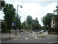
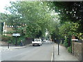
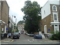
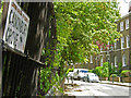
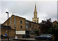
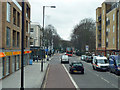
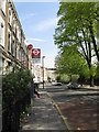
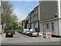
Photos of N1 2PN


Area Information
Living in N1 2PN means inhabiting a densely populated, compact residential cluster in north London. The area covers just 3,022 square metres, yet it accommodates 1,845 residents, translating to a staggering population density of 610,428 people per square kilometre. This suggests a tightly knit, urban environment where proximity to amenities and transport is a defining feature. The area’s small footprint and high density create a sense of immediacy—local shops, schools, and transport hubs are all within practical reach. While the data does not specify historical or cultural context, the presence of multiple rail, metro, and bus stops indicates a long-standing role as a transit-oriented community. For those seeking a blend of convenience and connectivity, N1 2PN offers a compact living experience, though its size may limit space for larger households or private gardens. The area’s demographics—predominantly adults aged 30–64—suggest a mature, settled population, likely drawn by the proximity to central London’s opportunities.
- Area Type
- Postcode
- Area Size
- 3022 m²
- Population
- 1845
- Population Density
- 17308 people/km²
The property market in N1 2PN is dominated by flats, with 18% of residents owning their homes. This suggests a rental-heavy market, where flats are the primary housing type. Given the area’s small size and high population density, the housing stock is likely limited to multi-unit buildings, which may appeal to those prioritising convenience over space. For buyers, this presents challenges: the small footprint of the area means competition for available properties, and the low home ownership rate indicates a market where landlords and renters predominate. Prospective buyers should consider whether the area’s compact nature aligns with their needs, as private gardens or larger homes are unlikely to be available. The proximity to transport links and amenities may offset the lack of space for some, but the limited housing stock means opportunities for purchase are scarce.
House Prices in N1 2PN
Showing 1 properties
| Address | Type | Beds | Baths | Last Sale Price | Last Sale Date | |
|---|---|---|---|---|---|---|
| Greenpeace, 2 Canonbury Villas, London, N1 2PN | office_workshop | - | - | - | - |
Energy Efficiency in N1 2PN
Daily life in N1 2PN is shaped by its proximity to a range of amenities. Retail options include Tesco New, Planet Organic Islington, and Sainsburys Upper, offering both everyday essentials and organic choices. The area’s transport links also grant access to leisure opportunities, such as the Camden Lock Waterbus and nearby parks, though specific green spaces are not detailed in the data. The presence of multiple bus and coach stations, including Green Line Coach Station, ensures easy access to further destinations. While the data does not specify dining or entertainment venues, the density of retail and transport options suggests a dynamic, convenient environment. Residents can likely walk or cycle to most amenities, reducing reliance on cars. This compactness fosters a lifestyle centred on accessibility, though the lack of detailed information on parks or recreational facilities leaves some aspects of the area’s character unexplored.
Amenities
Schools
The nearest school to N1 2PN is St Mary’s CofE Primary School, a primary institution with a ‘good’ Ofsted rating. This suggests a reliable foundation for early education, though the data does not mention secondary schools or other educational institutions. Families with young children may find this school sufficient for primary education but would need to look further afield for secondary schooling. The absence of additional schools in the data implies that parents may need to travel beyond N1 2PN for comprehensive educational options. However, the ‘good’ rating at St Mary’s indicates a standard of teaching and facilities that meets national benchmarks, which is a positive for families prioritising quality primary education.
| Rank | School | Type | Entry gender | Ages |
|---|
Explore more schools in this area
Go to Schools tabDemographics
The community in N1 2PN is predominantly composed of adults aged 30–64, with a median age of 47. This suggests a mature population, likely established in their careers and family life. Home ownership is relatively low, with only 18% of residents owning their homes—a figure that implies the majority live in rental properties, possibly flats given the accommodation type listed. The area is overwhelmingly White, though no specific data on other ethnic groups is provided. The high population density of 610,428 people per square kilometre indicates a tightly packed urban environment, which may influence social dynamics and the character of public spaces. For quality of life, this density could mean limited private outdoor space but strong community interaction. The lack of data on deprivation levels means it is unclear whether this density correlates with socioeconomic challenges, though the low home ownership rate may suggest a reliance on rental markets.
Household Size
Accommodation Type
Tenure
Ethnic Group
Religion
Household Composition
Age
Household Deprivation
NS-SEC
Explore more demographic insights in this area
Go to Demographics tabPlanning
Planning Constraints
- Flood RiskPremium
- Ramsar Wetland SitesPremium
- Area of Outstanding Natural BeautyPremium
- Protected Nature ReservePremium
- Protected WoodlandPremium