Area Overview for N1 1LF
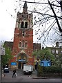
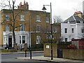
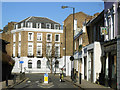
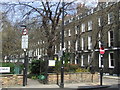
Photos of N1 1LF


Area Information
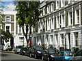
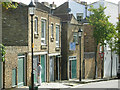
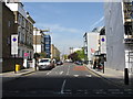
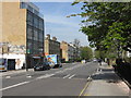
N1 1LF is a small residential postcode in north London, home to 1,845 people. It forms a compact cluster of properties, primarily flats, catering to a community of adults aged 30–64, with a median age of 47. This area is well-connected, with multiple rail, metro, and bus routes within reach, making it a practical choice for commuters. The population is predominantly White, and the area’s modest size means it feels intimate rather than sprawling. Daily life here is shaped by proximity to retail hubs like Budgens Barnsbury and Sainsburys Upper, alongside easy access to transport links such as Highbury & Islington Station. While the area lacks large green spaces or major landmarks, its strength lies in its accessibility to central London’s amenities. Residents benefit from excellent broadband connectivity and a balanced mix of local services, though the relatively high proportion of renters (34% home ownership) suggests a transient or professional demographic. N1 1LF is not a place for grand estates or sprawling suburbs, but for those seeking a manageable, connected living environment in a mature part of the city.
- Area Type
- Postcode
- Area Size
- Not available
- Population
- 1845
- Population Density
- 17505 people/km²
The property market in N1 1LF is characterised by a low home ownership rate (34%) and a predominance of flats. This suggests the area is more of a rental market than an owner-occupied one, with limited scope for long-term investment in private property. The compact nature of the postcode means housing stock is constrained, and buyers should expect a focus on smaller, urban-style living. Flats are the primary accommodation type, likely reflecting the area’s historical development and proximity to transport hubs. For those considering purchase, the small size of the area and its surrounding clusters may limit availability, making it a niche market for those prioritising location over property size. The lack of larger homes or detached properties means this is unlikely to appeal to growing families or those seeking extensive living space.
House Prices in N1 1LF
No properties found in this postcode.
Energy Efficiency in N1 1LF
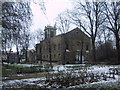
Living in N1 1LF offers access to a range of amenities within walking or short transit distance. Retail options include Budgens Barnsbury and Planet Organic Islington, providing everyday shopping and organic groceries. The area’s transport network is its standout feature, with rail stations like Highbury & Islington and metro stops such as Angel Station ensuring swift access to London’s cultural and commercial hubs. Ferry piers like Blackfriars Pier and Bankside Pier add flexibility for river travel, while bus routes connect to major destinations. Though the area lacks large parks or leisure facilities, its proximity to central London means residents can easily access larger recreational spaces. The convenience of multiple transport options and nearby retail makes daily life efficient, though the small postcode size means the community is tightly focused on local services rather than expansive amenities.
Amenities
Schools
| Rank | School | Type | Entry gender | Ages |
|---|
Explore more schools in this area
Go to Schools tabDemographics
The community in N1 1LF is predominantly composed of adults aged 30–64, with a median age of 47. This suggests a stable, middle-aged population, likely including professionals and families. Home ownership is relatively low at 34%, indicating that most residents rent their properties. The accommodation type is largely flats, reflecting the area’s compact nature and likely influence of urban planning. The predominant ethnic group is White, though no specific diversity metrics are provided. The absence of data on deprivation or household composition means the quality of life here cannot be fully assessed, but the age profile and ownership figures imply a mix of established residents and those in transient employment. The area’s small size and flat-dominated housing stock suggest a focus on convenience over space, catering to those prioritising accessibility over property size.
Household Size
Accommodation Type
Tenure
Ethnic Group
Religion
Household Composition
Age
Household Deprivation
NS-SEC
Explore more demographic insights in this area
Go to Demographics tabPlanning
Planning Constraints
- Flood RiskPremium
- Ramsar Wetland SitesPremium
- Area of Outstanding Natural BeautyPremium
- Protected Nature ReservePremium
- Protected WoodlandPremium