Area Overview for N1 0SL
Photos of N1 0SL
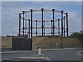
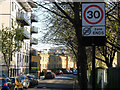
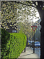
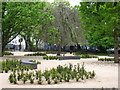
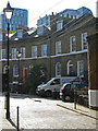
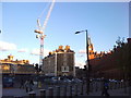
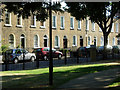
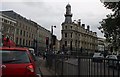


100 photos from this area
Area Information
Key information about the N1 0SL including its size, population, and administrative classification.
- Area Type
- Postcode
- Area Size
- 1.0 hectares
- Population
- 1599
- Population Density
- 11495 people/km²
House Prices in N1 0SL
53
Properties
£588,333
Average Sold Price
£300,000
Lowest Price
£800,000
Highest Price
Showing 53 properties
| Address | Type | Beds | Baths | Last Sale Price | Last Sale Date | |
|---|---|---|---|---|---|---|
| 185A Caledonian Road, London, N1 0SL | Flat | 2 | 1 | £800,000 | Dec 2021 | |
| First And Second Floor Flat, 183 Caledonian Road, London, N1 0SL | Flat | 1 | 1 | £665,000 | Oct 2021 | |
| Flat A, 191 Caledonian Road, London, N1 0SL | Flat | 1 | 1 | £300,000 | Apr 2001 | |
| Flat 2, 185-187 Caledonian Road, London, N1 0SL | Flat | 2 | 1 | - | - | |
| Flat C, 159 Caledonian Road, London, N1 0SL | Flat | 2 | 1 | - | - | |
| Flat A, 175 Caledonian Road, London, N1 0SL | Flat | 1 | 1 | - | - | |
| Flat A, 165 Caledonian Road, London, N1 0SL | Flat | 2 | - | - | - | |
| Flat B, 179 Caledonian Road, London, N1 0SL | Maisonette | 1 | 1 | - | - | |
| Flat C, 165 Caledonian Road, London, N1 0SL | Flat | - | - | - | - | |
| Flat C, 169-171 Caledonian Road, London, N1 0SL | Flat | 2 | 2 | - | - |
Page 1 of 6
Energy Efficiency in N1 0SL
Amenities
Schools
| Rank | School | Type | Entry gender | Ages |
|---|
Explore more schools in this area
Go to Schools tabDemographics
Household Size
Family (3-5 people)
most common
Accommodation Type
Flats
most common
Tenure
20
majority
Ethnic Group
White
most common
Religion
N/A
most common
Household Composition
N/A
most common
Age
47
median
Adults (30-64 years)
most common
Household Deprivation
N/A
with no deprivation
NS-SEC
34
in Lower managerial occupations
Explore more demographic insights in this area
Go to Demographics tabPlanning
Planning Constraints
- Flood RiskPremium
- Ramsar Wetland SitesPremium
- Area of Outstanding Natural BeautyPremium
- Protected Nature ReservePremium
- Protected WoodlandPremium