Area Overview for N1 0JR
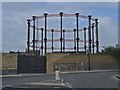
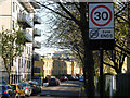
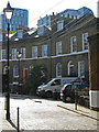
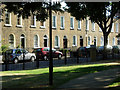
Photos of N1 0JR


Area Information
Living in N1 0JR means inhabiting a small, tightly knit residential cluster in north London. With a population of 1,599, the area is compact yet well-served by transport and amenities. The community is predominantly composed of adults aged 30–64, reflecting a mature demographic. Daily life here balances proximity to urban hubs with a quieter residential vibe. The postcode sits near key transport arteries, including Caledonian Road & Barnsbury Station and King’s Cross St. Pancras Underground Station, offering easy access to central London. Residents benefit from a range of local shops, from Tesco Cally to Co-op Caledonian, and nearby schools that cater to children from nursery through primary education. While the area is small, its connectivity to major transport links and educational institutions makes it appealing for those seeking convenience without sacrificing a sense of community.
- Area Type
- Postcode
- Area Size
- Not available
- Population
- 1599
- Population Density
- 11495 people/km²
The property market in N1 0JR is characterised by a high proportion of rented flats, with only 20% of homes owner-occupied. This suggests a rental-dominated market, likely shaped by the area’s compact size and proximity to transport hubs. Flats are the primary accommodation type, which is common in urban settings where space is limited. For buyers, this means competition for owner-occupied properties may be fierce, and the market is likely to cater more to investors or those seeking long-term rentals. The small area’s limited housing stock means buyers should consider nearby neighbourhoods for broader options. The prevalence of flats also indicates a focus on convenience over spacious living, appealing to commuters and those prioritising location over property size.
House Prices in N1 0JR
No properties found in this postcode.
Energy Efficiency in N1 0JR
Daily life in N1 0JR is shaped by its proximity to retail, transport, and leisure hubs. Local shops include Tesco Cally, Iceland Caledonian, and Co-op Caledonian, offering essential goods within walking distance. The area’s transport links are extensive, with major stations like King’s Cross St. Pancras and Caledonian Road & Barnsbury Station providing access to London’s rail and metro networks. Ferry piers such as Camden Lock Waterbus and Savoy Pier connect residents to riverside destinations, while bus routes and coach stations like Green Line Coach Station ensure flexibility. The mix of retail, transport, and water-based mobility options creates a dynamic lifestyle, blending urban convenience with opportunities for recreation and exploration.
Amenities
Schools
N1 0JR is served by a mix of nursery and primary schools, including Kate Greenaway Nursery School and Children’s Centre, Copenhagen Primary School, and St Andrew’s (Barnsbury) Church of England Primary School, which holds a ‘good’ Ofsted rating. Blessed Sacrament RC Primary School and New River College Medical also fall within the area. The presence of both state and faith-based schools provides families with choice, though the absence of secondary schools means students must travel to nearby districts. The ‘good’ rating at St Andrew’s suggests at least one institution meets high standards, but the overall quality of education depends on individual school performance and proximity. Parents should visit schools in person to assess suitability for their children’s needs.
| Rank | School | Type | Entry gender | Ages |
|---|
Explore more schools in this area
Go to Schools tabDemographics
N1 0JR’s population is predominantly adults aged 30–64, with a median age of 47. This suggests a stable, established community rather than a transient one. Home ownership is low at 20%, indicating that most residents rent their properties. The accommodation type is almost entirely flats, which is typical for inner-city areas. The predominant ethnic group is White, though specific diversity statistics are not provided. The age profile implies a focus on family life, with local schools playing a central role. The low home ownership rate may reflect the area’s rental market dynamics, which could influence housing affordability and long-term stability for residents.
Household Size
Accommodation Type
Tenure
Ethnic Group
Religion
Household Composition
Age
Household Deprivation
NS-SEC
Explore more demographic insights in this area
Go to Demographics tabPlanning
Planning Constraints
- Flood RiskPremium
- Ramsar Wetland SitesPremium
- Area of Outstanding Natural BeautyPremium
- Protected Nature ReservePremium
- Protected WoodlandPremium