Area Overview for N1 0JA
Photos of N1 0JA
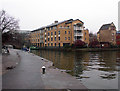
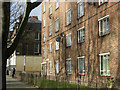
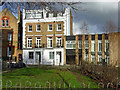

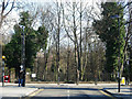
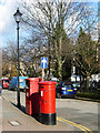
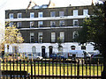
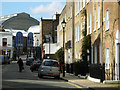
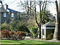
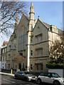
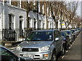
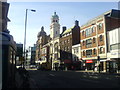
100 photos from this area
Area Information
Key information about the N1 0JA including its size, population, and administrative classification.
- Area Type
- Postcode
- Area Size
- 3217 m²
- Population
- 1747
- Population Density
- 11796 people/km²
House Prices in N1 0JA
28
Properties
£1,093,167
Average Sold Price
£285,000
Lowest Price
£1,725,000
Highest Price
Showing 28 properties
| Address | Type | Beds | Baths | Last Sale Price | Last Sale Date | |
|---|---|---|---|---|---|---|
| 13 Cloudesley Place, London, N1 0JA | Terraced | 3 | 1 | £1,700,000 | May 2025 | |
| 5 Cloudesley Place, London, N1 0JA | Terraced | 3 | 2 | £1,725,000 | Mar 2025 | |
| 3 Cloudesley Place, London, N1 0JA | Retail | 3 | 1 | £1,600,000 | May 2022 | |
| 10 Cloudesley Place, London, N1 0JA | Terraced | - | - | £1,555,000 | May 2021 | |
| 21 Cloudesley Place, London, N1 0JA | Terraced | 3 | 2 | £1,275,000 | Sep 2019 | |
| 9 Cloudesley Place, London, N1 0JA | Terraced | 4 | 2 | £1,410,000 | Apr 2019 | |
| 17 Cloudesley Place, London, N1 0JA | Terraced | 1 | 1 | £1,123,000 | Mar 2019 | |
| 23 Cloudesley Place, London, N1 0JA | Flat | - | - | £460,000 | Nov 2015 | |
| 20 Cloudesley Place, London, N1 0JA | Terraced | 3 | - | £825,000 | Jan 2008 | |
| 8 Cloudesley Place, London, N1 0JA | Terraced | - | - | £600,000 | Mar 2006 |
Page 1 of 3
Energy Efficiency in N1 0JA
Amenities
Schools
| Rank | School | Type | Entry gender | Ages |
|---|
Explore more schools in this area
Go to Schools tabDemographics
Household Size
Two person
most common
Accommodation Type
Flats
most common
Tenure
34
majority
Ethnic Group
White
most common
Religion
N/A
most common
Household Composition
N/A
most common
Age
47
median
Adults (30-64 years)
most common
Household Deprivation
N/A
with no deprivation
NS-SEC
61
in Lower managerial occupations
Explore more demographic insights in this area
Go to Demographics tabPlanning
Planning Constraints
- Flood RiskPremium
- Ramsar Wetland SitesPremium
- Area of Outstanding Natural BeautyPremium
- Protected Nature ReservePremium
- Protected WoodlandPremium