Area Overview for N1 0HH
Photos of N1 0HH


Area Information
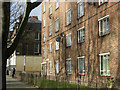
Living in N1 0HH means being part of a small, tightly knit residential cluster in north London. With a population of 1,665, the area is compact but well-served by transport links and amenities. The postcode covers a mix of flats, reflecting its focus on rental housing. Daily life here is shaped by proximity to major transport hubs, including Angel Station and King’s Cross St. Pancras Underground Station, which connect residents to central London and beyond. The median age of 47 suggests a community of established adults, many of whom are likely commuters or professionals working in nearby business districts. Safety is a key feature, with a low crime risk score of 71 and no flood or environmental hazards. For families, the area offers access to Vittoria Primary School, rated good by Ofsted, though secondary education options are not listed. The blend of convenience, safety, and connectivity makes N1 0HH appealing for those prioritising practicality over sprawling suburban living.
- Area Type
- Postcode
- Area Size
- Not available
- Population
- 1665
- Population Density
- 23752 people/km²
The property market in N1 0HH is characterised by a very low home ownership rate of 11%, indicating that the area is not a traditional owner-occupied community. Instead, it is likely dominated by rental properties, with flats being the predominant accommodation type. This suggests a focus on short-term tenancies rather than long-term investment. For buyers, the small size of the area and its limited housing stock mean that available properties may be scarce, requiring consideration of nearby postcodes for a broader selection. The flat-centric market may appeal to those seeking affordable, manageable living spaces in a well-connected location. However, the low ownership rate also implies limited scope for property value appreciation, which could be a concern for investors. Prospective buyers should evaluate whether the area’s practical advantages outweigh its limitations in terms of ownership potential.
House Prices in N1 0HH
No properties found in this postcode.
Energy Efficiency in N1 0HH
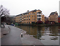
Daily life in N1 0HH is enriched by a range of nearby amenities. Retail options include Iceland Chapel, Waitrose Islington, and M&S Islington, offering convenience for shopping and daily essentials. The area’s transport links provide access to major hubs like London Kings Cross Railway Station and Victoria Coach Station, facilitating travel beyond the immediate vicinity. While parks or leisure facilities are not explicitly listed, the proximity to ferry piers such as Blackfriars and Savoy suggests opportunities for water-based recreation. The presence of multiple metro, rail, and bus stops ensures that residents can easily reach cultural, commercial, and recreational destinations. This blend of retail, transport, and connectivity contributes to a practical, though compact, lifestyle that prioritises accessibility over expansive green spaces.
Amenities
Schools
The nearest school to N1 0HH is Vittoria Primary School, a primary institution with a good Ofsted rating. This provides families with a quality educational option for younger children, though no secondary schools are listed in the data. The presence of a well-rated primary school is a significant draw for families prioritising education, but parents of older children may need to look further afield for secondary schooling. The single school listed reflects the area’s small size and limited infrastructure, which could be a consideration for those requiring a broader range of educational facilities. For primary education, however, Vittoria offers a reliable and positively assessed option.
| Rank | School | Type | Entry gender | Ages |
|---|
Explore more schools in this area
Go to Schools tabDemographics
The community in N1 0HH is predominantly composed of adults aged 30–64, with a median age of 47. Home ownership is exceptionally low at 11%, indicating that most residents are renters. The accommodation type is largely flats, reflecting the area’s density and focus on rental housing. The predominant ethnic group is White, though specific data on diversity beyond this is not provided. This demographic profile suggests a mature, stable population with established careers and family structures. The low home ownership rate implies limited opportunities for property investment or long-term equity growth, which may influence buyers’ perceptions of the area. The absence of detailed deprivation data means quality of life factors such as access to services or income levels remain unspecified. However, the safety profile and transport links suggest a functional, if modest, living environment.
Household Size
Accommodation Type
Tenure
Ethnic Group
Religion
Household Composition
Age
Household Deprivation
NS-SEC
Explore more demographic insights in this area
Go to Demographics tabPlanning
Planning Constraints
- Flood RiskPremium
- Ramsar Wetland SitesPremium
- Area of Outstanding Natural BeautyPremium
- Protected Nature ReservePremium
- Protected WoodlandPremium