Area Overview for Myatt's Fields Ward
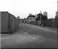
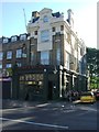
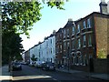
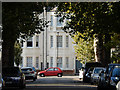
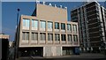
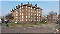
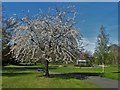
Photos of Myatt's Fields Ward

Area Information
Myatt's Fields Ward is a distinct district within the borough that covers exactly 81.9 hectares. The land holds a population of 2,317 residents, creating a densely populated environment with 2,829 people living per square kilometre. This high density defines the daily rhythm of life here, where neighbours are inevitably close. Living in Myatt's Fields Ward means navigating a territory where every square metre is occupied by a community of nearly 2,400 individuals. The area's compact size concentrates social interactions, making it feel like a tight-knit neighbourhood rather than a sprawling suburb. You are surrounded by a population that is significantly concentrated within these boundaries. This proximity influences noise levels, street activity, and the general pace of life for anyone purchasing homes in Myatt's Fields Ward. The ward operates as a self-contained unit, offering a specific living experience characterised by this intense concentration of people across the 81.9 hectares of land. Understanding these physical parameters helps you grasp the true scale of the community you would join. The sheer number of people in such a small footprint suggests a vibrant yet potentially compact environment where private and public spaces intertwine.
- Area Type
- District Borough Unitary Ward
- Area Size
- 81.9 hectares
- Population
- 2317
- Population Density
- 2829 people/km²
Demographics
You will find a community defined by an advanced age profile when looking at Myatt's Fields Ward. The demographic median age sits at 70 years, meaning the average resident is significantly older than the national figure. Nearly the entire population falls into the 'Age: Total' category based on current breakdowns, indicating a mature demographic shift. Home ownership stands at just 28%, a striking figure that defines who owns their roof in Myatt's Fields Ward. The vast majority of households are likely rented, shaping a different dynamic compared to owner-occupied zones. You encounter a population with very specific needs regarding healthcare, leisure, and community support due to this age skew. The low ownership rate suggests you are entering a market where purchasing power varies significantly, or tenure rules constrain many locals. Accommodation types reflect this tenure reality, likely featuring a mix of rentals suited to elderly residents and downsizers. School-age children are not the primary demographic, though schools near Myatt's Fields Ward still cater to the broader catchment area. The community composition is homogenous in its ageing trend, yet the low ownership rate introduces economic diversity. Understanding these figures helps you anticipate who your neighbours might be and what local services remain most active.
Household Size
Accommodation Type
Tenure
Ethnic Group
Religion
Household Composition
Age
Household Deprivation
NS-SEC
Explore more demographic insights in this area
Go to Demographics tabPlanning
Planning Constraints
- Flood RiskPremium
- Ramsar Wetland SitesPremium
- Area of Outstanding Natural BeautyPremium
- Protected Nature ReservePremium
- Protected WoodlandPremium
- Crime RiskPremium