Area Overview for Merton Park Ward
Photos of Merton Park Ward


Area Information
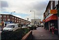
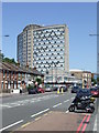
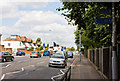
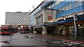
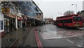
Merton Park Ward is a small, suburban residential area located within the London Borough of Merton. The district covers an area of 1.7 km², making it a compact neighbourhood focused on residence rather than commercial activity. You will find this ward approximately 7.25 miles southwest of central London, bordering Colliers Wood, Morden, South Wimbledon, and Raynes Park. The layout follows a garden suburb model established during the late 19th and early 20th centuries. Tree-lined roads feature detached and semi-detached houses, creating a layout typical of period development. The area was primarily rural farmland until John Innes purchased the land in 1864. Development occurred between 1870 and 1904, resulting in the housing stock you see today. After Innes died in 1904, his Manor House grounds became a public park and the site of the John Innes Horticultural Institution. This institution served as a key centre for genetics research until it relocated in 1950. The historic parish church of St Mary's, founded in the 12th century, remains a central landmark. It is where John Innes is buried, alongside the remnants of Merton Priory's Western Gate. Living in Merton Park Ward means enjoying a community with a strong sense of history. Several conservation areas protect the historic housing, including the core Merton Park area designated in 1968. Other notable sites include John Innes on Wilton Crescent, Merton Hall Road, the Leather Bottle pub built in 1899, and Long Lodge from around 1720. The John Innes Society has preserved the community focus since 1971. This local management ensures the character of the estate remains intact for current and future residents.
- Area Type
- District Borough Unitary Ward
- Area Size
- 1.7 km²
- Population
- Not available
- Population Density
- Not available
Demographics
The community in Merton Park Ward is defined by an older demographic profile. The median age of residents is 70 years, with the most common age range falling under the total age category statistic. This indicates a population skewed significantly towards seniors compared to the national average. You should expect a neighbourhood where many long-term residents have lived here for decades. London Borough of Merton council data shows that home ownership stands at 70%. This high percentage reflects a settled community where residents have built their lives in the area over time. The remaining 30% live in rented accommodation. The ward lacks specific breakdowns for household composition, predominant ethnic group, or religious affiliation in the available records. These sections do not contain the detailed statistics required to describe diversity or family structures in this specific ward. The absence of granular data on ethnicity or religion prevents a detailed discussion of community diversity within Merton Park Ward. Similarly, information regarding the specific mix of households, such as those with children versus single-person homes, is not included in the provided dataset. You cannot determine the specific breakdown of single, married, or cohabiting households without these figures. The only demographic certainty is the high proportion of owner-occupiers and the advanced median age of the population.
Household Size
Accommodation Type
Tenure
Ethnic Group
Religion
Household Composition
Age
Household Deprivation
NS-SEC
Explore more demographic insights in this area
Go to Demographics tabPlanning
Planning Constraints
- Flood RiskPremium
- Ramsar Wetland SitesPremium
- Area of Outstanding Natural BeautyPremium
- Protected Nature ReservePremium
- Protected WoodlandPremium
- Crime RiskPremium