Area Overview for Little Ilford Ward
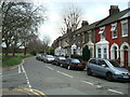
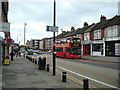
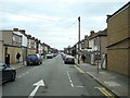
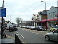
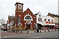
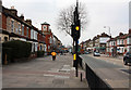
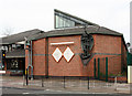
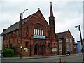
Photos of Little Ilford Ward

Area Information
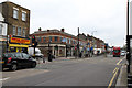
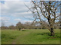
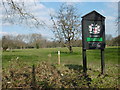
Living in Little Ilford Ward offers a distinctive experience in the London Borough of Newham, characterised by its compact footprint and historical depth. This electoral ward spans just 2.0 km² and serves as one of the few districts where history merges with modern suburban life. The area is named after its location next to the River Roding, a waterway that historically defined the boundary with Great Ilford to the south. You are joining a community of 3,694 residents, making it a relatively small neighbourhood within the wider urban sprawl. The location sits adjacent to Manor Park and relies on its historic centre, anchored by St Mary's Church on Church Street, which has stood since at least the 12th century. Life here is defined by a mix of ancient roots and contemporary living. Archaeological evidence confirms significant prehistoric settlement, including Mortlake ware pottery and Iron Age roundhouses found at the nearby Little Ilford School. Roman activity from approximately AD 180 to 410 is also recorded on this soil. The ward's proximity to former railway lines places it in a convenient suburban pocket near East Ham station. For those considering homes in Little Ilford Ward, the area provides a quiet, historically rich setting just a few miles from Stratford. The combination of river adjacency, 11th-century ecclesiastical heritage, and modern amenity access creates a specific living environment that stands apart from the busier centres of Newham.
- Area Type
- District Borough Unitary Ward
- Area Size
- 2.0 km²
- Population
- 3694
- Population Density
- 1880 people/km²
Demographics
The community within Little Ilford Ward has a clearly defined age profile that differs significantly from the national average. The median age is 70, and the age of 70 represents the most common demographic marker for the area. This indicates a neighbourhood heavily weighted towards older residents, with a typical household likely comprised of seniors on fixed incomes or retired individuals. With 3,694 people living in this 2.0 km² space, the density reaches 1,880 people per square kilometre. This relatively high concentration supports a tight-knit social structure, particularly given the limited land area and the dominance of older age groups. Home ownership stands at 34% within the ward. This figure implies that roughly two-thirds of residents are renters rather than owners, suggesting a market where affordable rental options are prevalent alongside a smaller owner-occupier base. The high median age correlates with a potential future shift in household composition as the current population ages. Schools near Little Ilford Ward serve as a focal point not just for education but as a community anchor, noted for specific archaeological finds that connect past and present generations. Understanding this demographic snapshot helps you recognise that Little Ilford Ward functions as a sheltered environment for the local elderly population rather than a family-heavy zone. The low home ownership rate necessitates careful consideration of rental longevity versus investment potential for new arrivals.
Household Size
Accommodation Type
Tenure
Ethnic Group
Religion
Household Composition
Age
Household Deprivation
NS-SEC
Explore more demographic insights in this area
Go to Demographics tabPlanning
Planning Constraints
- Flood RiskPremium
- Ramsar Wetland SitesPremium
- Area of Outstanding Natural BeautyPremium
- Protected Nature ReservePremium
- Protected WoodlandPremium