Area Overview for Leytonstone Ward
Photos of Leytonstone Ward

Area Information
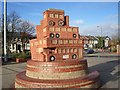
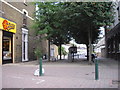
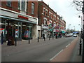
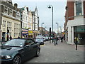
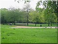
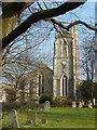
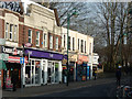
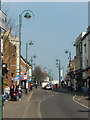
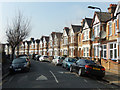
Leytonstone Ward stands as a distinct electoral ward within the London Borough of Waltham Forest, covering an area of just 1.3 km². You are looking at a compact neighbourhood that has evolved significantly since its origins dating back to the early 14th century as the hamlet of Leyton-atte-Stone. Originally a rural settlement named after the River Lea and a Roman milestone, the area transformed into a desirable country retreat for wealthy merchants by the early 18th century. This character changed permanently with the opening of Leytonstone railway station in 1856, which catalysed rapid urbanisation and turned the location into a suburban dormitory town. Today, you will find Leytonstone functioning as a hub where Victorian housing mixes with modern developments, largely shaped by historical institutions such as the Bethnal Green Schools for the Juvenile Poor. The ward divides into four council wards, including the central Leytonstone ward and the Cann Hall ward. One of the area's defining features is the preservation of open space; Forest land in the north and east escaped development following the Epping Forest Act 1878, securing over 200 acres for public use. Living in Leytonstone means you have access to this historic greenery while remaining minutes away from central London via the Central line.
- Area Type
- District Borough Unitary Ward
- Area Size
- 1.3 km²
- Population
- Not available
- Population Density
- Not available
Demographics
The community profile of Leytonstone Ward reveals a settled population with a median age of 70. This figure indicates a neighbourhood where many residents have put down roots and remained in their homes for decades. You are entering an area where the most common age range spans the total population, suggesting a high level of stability rather than transient living. With a home ownership rate of 47%, you will find that while slightly less than half of residents own their properties, the majority are likely tenants. This split reflects a mixed market where both long-term homeowners and renters coexist within the same streets. The demographic data suggests a mature community where the rhythm of daily life is likely influenced by an older resident base. When you consider what it means to live here, the 47% ownership ratio points to a system where access to homes often requires navigating a significant rental sector alongside purchasing opportunities. This balance affects everything from local investment patterns to the average tenure of people in their current addresses. You will be joining a community defined by this specific demographic structure, making it distinct from younger, first-time buyer hubs found in other parts of London.
Household Size
Accommodation Type
Tenure
Ethnic Group
Religion
Household Composition
Age
Household Deprivation
NS-SEC
Explore more demographic insights in this area
Go to Demographics tabPlanning
Planning Constraints
- Flood RiskPremium
- Ramsar Wetland SitesPremium
- Area of Outstanding Natural BeautyPremium
- Protected Nature ReservePremium
- Protected WoodlandPremium