Area Overview for Larkswood Ward
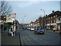
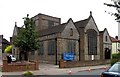
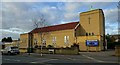
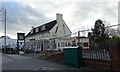
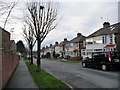
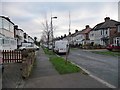
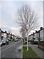
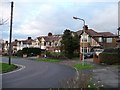
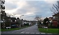
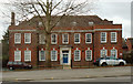
Photos of Larkswood Ward


Area Information
Living in Larkswood Ward means residing in one of the London Borough of Waltham Forest's electoral wards, a district situated in northeast London. This area spans a compact 2.2 km² and sits near the borders with the London Boroughs of Redbridge and Enfield. The ward encompasses residential areas centred around the coordinate point 51.613645, -0.009935, placing it firmly within the established fabric of the borough. You are located close to key arterial routes, including the North Circular Road, which connects you to the wider city network without requiring you to travel far from home. The history of this neighbourhood dates back to the 1978 elections, where Larkswood first appeared on ward maps and continues to elect three councillors to the London Borough Council. Daily life here is defined by a strong connection to local thoroughfares such as High Road Leyton, Woodford New Road, and Lea Bridge Road. These A-roads provide straightforward access for your daily commute or local shopping trips. The area is underpinned by a long-standing administrative framework, reflecting its integration into the local governance structure since the early 1980s. When you consider homes in Larkswood Ward, you are looking at a settled community with clear geographic boundaries. The ward includes specific localities like Highams Park, as indicated by recent policy documents regarding pedestrian-friendly streets. Your daily journey will likely involve navigating a persistent network of A-roads including the A104 and A106. This layout ensures practical connectivity while maintaining a distinct identity separate from neighbouring districts. The area offers a stable environment where the relationship between residential zones and major transport links remains consistent for all residents.
- Area Type
- District Borough Unitary Ward
- Area Size
- 2.2 km²
- Population
- Not available
- Population Density
- Not available
Demographics
The community in Larkswood Ward is defined by a mature population profile. With a median age of 70, this area hosts a significantly older demographic compared to the national average. The most common age range data indicates a high concentration of elderly residents, meaning you will encounter a neighbourhood suited to retirement living rather than young families. This age structure suggests a quieter residential atmosphere where daily life moves at a slower pace than in denser urban centres. Home ownership stands at 60% within the ward. This figure indicates that nearly half of the households rely on renting their properties, which is a crucial factor if you are weighing the costs of purchasing a home versus renting. The ownership split reflects a balanced market where long-term residents have secured their dwellings, yet a substantial portion of the population remains within the rental sector. This dynamic often influences local services and community initiatives, as both homeowners and tenants play a role in the ward's character. Understanding accommodation types provides further insight into the physical layout of homes in Larkswood Ward. While specific breakdowns of flats versus houses are not detailed beyond the total accommodation category, the high home ownership rate suggests a traditional housing stock often favoured by older generations. The ward also contains specific cultural and administrative diversity markers, though exact ethnic group statistics are not provided in the current data. You should assume a standard multicultural London demographic, common to Waltham Forest's neighbourhoods. This mix ensures that essential services cater to a broad range of needs.
Household Size
Accommodation Type
Tenure
Ethnic Group
Religion
Household Composition
Age
Household Deprivation
NS-SEC
Explore more demographic insights in this area
Go to Demographics tabPlanning
Planning Constraints
- Flood RiskPremium
- Ramsar Wetland SitesPremium
- Area of Outstanding Natural BeautyPremium
- Protected Nature ReservePremium
- Protected WoodlandPremium
- Crime RiskPremium