Area Overview for KT9 1JU
Photos of KT9 1JU
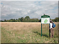
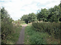
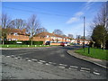
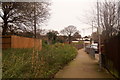
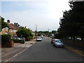
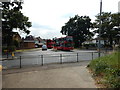
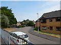
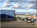
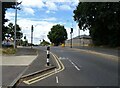
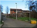
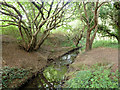
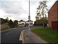
19 photos from this area
Area Information
Key information about the KT9 1JU including its size, population, and administrative classification.
- Area Type
- Postcode
- Area Size
- 9877 m²
- Population
- 1334
- Population Density
- 4419 people/km²
House Prices in KT9 1JU
27
Properties
£284,995
Average Sold Price
£69,000
Lowest Price
£460,000
Highest Price
Showing 27 properties
| Address | Type | Beds | Baths | Last Sale Price | Last Sale Date | |
|---|---|---|---|---|---|---|
| 26 Roebuck Road, Chessington, KT9 1JU | Terraced | 3 | 1 | £458,500 | Mar 2025 | |
| 18 Roebuck Road, Chessington, KT9 1JU | Terraced | 3 | 1 | £425,000 | Feb 2023 | |
| 28 Roebuck Road, Chessington, KT9 1JU | Terraced | 3 | 2 | £460,000 | Jan 2023 | |
| 24 Roebuck Road, Chessington, KT9 1JU | house | - | - | £450,000 | Aug 2022 | |
| 44 Roebuck Road, Chessington, KT9 1JU | house | - | - | £412,000 | Aug 2021 | |
| 14 Roebuck Road, Chessington, KT9 1JU | Terraced | 3 | 1 | £440,000 | Jul 2020 | |
| 8 Roebuck Road, Chessington, KT9 1JU | Terraced | 3 | - | £340,550 | Nov 2016 | |
| 2 Roebuck Road, Chessington, KT9 1JU | Terraced | 3 | 1 | £348,950 | Apr 2015 | |
| 38 Roebuck Road, Chessington, KT9 1JU | Terraced | 3 | - | £250,000 | Nov 2013 | |
| 30 Roebuck Road, Chessington, KT9 1JU | Terraced | 3 | 1 | £399,950 | Dec 2012 |
Page 1 of 3
Energy Efficiency in KT9 1JU
Amenities
Schools
| Rank | School | Type | Entry gender | Ages |
|---|
Explore more schools in this area
Go to Schools tabDemographics
Household Size
Family (3-5 people)
most common
Accommodation Type
Houses
most common
Tenure
76
majority
Ethnic Group
White
most common
Religion
N/A
most common
Household Composition
N/A
most common
Age
47
median
Adults (30-64 years)
most common
Household Deprivation
N/A
with no deprivation
NS-SEC
36
in Lower managerial occupations
Explore more demographic insights in this area
Go to Demographics tabPlanning
Planning Constraints
- Flood RiskPremium
- Ramsar Wetland SitesPremium
- Area of Outstanding Natural BeautyPremium
- Protected Nature ReservePremium
- Protected WoodlandPremium