Area Overview for KT9 1EX
Photos of KT9 1EX
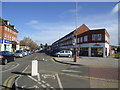
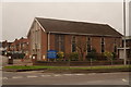
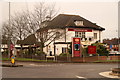
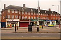
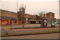
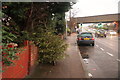
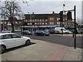
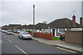
54 photos from this area
Area Information
Key information about the KT9 1EX including its size, population, and administrative classification.
- Area Type
- Postcode
- Area Size
- 8677 m²
- Population
- 1646
- Population Density
- 6287 people/km²
House Prices in KT9 1EX
26
Properties
£323,110
Average Sold Price
£89,650
Lowest Price
£545,000
Highest Price
Showing 26 properties
| Address | Type | Beds | Baths | Last Sale Price | Last Sale Date | |
|---|---|---|---|---|---|---|
| 8 Grange Road, Chessington, KT9 1EX | Semi-detached | 3 | 2 | £545,000 | Aug 2025 | |
| 28 Grange Road, Chessington, KT9 1EX | Semi-detached | 2 | 1 | £540,000 | Feb 2023 | |
| 32 Grange Road, Chessington, KT9 1EX | Semi-detached | 4 | 2 | £540,000 | Dec 2022 | |
| 50 Grange Road, Chessington, KT9 1EX | Retail | 3 | 1 | £520,000 | May 2022 | |
| 30 Grange Road, Chessington, KT9 1EX | Retail | 3 | 1 | £490,000 | Apr 2022 | |
| 10 Grange Road, Chessington, KT9 1EX | Semi-detached | 3 | 1 | £445,000 | Jan 2019 | |
| 4 Grange Road, Chessington, KT9 1EX | Semi-detached | 4 | 2 | £275,000 | Oct 2013 | |
| 44 Grange Road, Chessington, KT9 1EX | Bungalow | 2 | 2 | £310,000 | May 2013 | |
| 48 Grange Road, Chessington, KT9 1EX | Semi-detached | - | - | £210,000 | Apr 2006 | |
| 20 Grange Road, Chessington, KT9 1EX | house | - | - | £202,000 | Oct 2005 |
Page 1 of 3
Energy Efficiency in KT9 1EX
Amenities
Schools
| Rank | School | Type | Entry gender | Ages |
|---|
Explore more schools in this area
Go to Schools tabDemographics
Household Size
Family (3-5 people)
most common
Accommodation Type
Houses
most common
Tenure
64
majority
Ethnic Group
White
most common
Religion
N/A
most common
Household Composition
N/A
most common
Age
47
median
Adults (30-64 years)
most common
Household Deprivation
N/A
with no deprivation
NS-SEC
32
in Lower managerial occupations
Explore more demographic insights in this area
Go to Demographics tabPlanning
Planning Constraints
- Flood RiskPremium
- Ramsar Wetland SitesPremium
- Area of Outstanding Natural BeautyPremium
- Protected Nature ReservePremium
- Protected WoodlandPremium