Area Overview for KT9 1AW
Photos of KT9 1AW
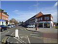
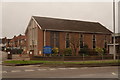
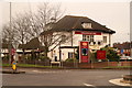
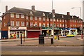
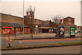
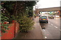
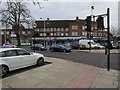
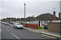
54 photos from this area
Area Information
Key information about the KT9 1AW including its size, population, and administrative classification.
- Area Type
- Postcode
- Area Size
- 5992 m²
- Population
- 1401
- Population Density
- 6618 people/km²
House Prices in KT9 1AW
18
Properties
£340,083
Average Sold Price
£169,000
Lowest Price
£510,000
Highest Price
Showing 18 properties
| Address | Type | Beds | Baths | Last Sale Price | Last Sale Date | |
|---|---|---|---|---|---|---|
| 42 Elm Road, Chessington, KT9 1AW | Semi-detached | 3 | - | £485,000 | Mar 2025 | |
| 70 Elm Road, Chessington, KT9 1AW | Terraced | 2 | 1 | £400,000 | Nov 2023 | |
| 52 Elm Road, Chessington, KT9 1AW | house | - | - | £510,000 | Apr 2021 | |
| 68 Elm Road, Chessington, KT9 1AW | Terraced | 2 | 1 | £375,000 | Dec 2018 | |
| 74 Elm Road, Chessington, KT9 1AW | Detached | 2 | 1 | £409,000 | Mar 2017 | |
| 80 Elm Road, Chessington, KT9 1AW | Detached | 3 | - | £445,000 | Jan 2015 | |
| 78 Elm Road, Chessington, KT9 1AW | Semi-detached | 3 | - | £375,000 | Dec 2014 | |
| 72 Elm Road, Chessington, KT9 1AW | Terraced | 2 | - | £218,000 | May 2011 | |
| 46 Elm Road, Chessington, KT9 1AW | house | - | - | £250,000 | May 2009 | |
| 44 Elm Road, Chessington, KT9 1AW | Semi-detached | - | - | £270,000 | Nov 2004 |
Page 1 of 2
Energy Efficiency in KT9 1AW
Amenities
Schools
| Rank | School | Type | Entry gender | Ages |
|---|
Explore more schools in this area
Go to Schools tabDemographics
Household Size
Family (3-5 people)
most common
Accommodation Type
Houses
most common
Tenure
86
majority
Ethnic Group
White
most common
Religion
N/A
most common
Household Composition
N/A
most common
Age
47
median
Adults (30-64 years)
most common
Household Deprivation
N/A
with no deprivation
NS-SEC
38
in Lower managerial occupations
Explore more demographic insights in this area
Go to Demographics tabPlanning
Planning Constraints
- Flood RiskPremium
- Ramsar Wetland SitesPremium
- Area of Outstanding Natural BeautyPremium
- Protected Nature ReservePremium
- Protected WoodlandPremium