Area Overview for KT6 7HT
Photos of KT6 7HT
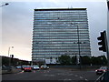
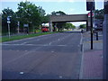
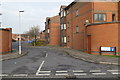
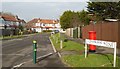
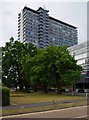
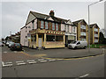
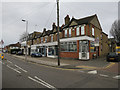
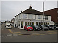
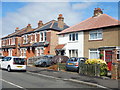
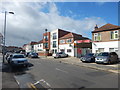
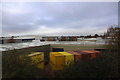
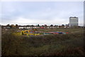
55 photos from this area
Area Information
Key information about the KT6 7HT including its size, population, and administrative classification.
- Area Type
- Postcode
- Area Size
- 7287 m²
- Population
- 1727
- Population Density
- 7396 people/km²
House Prices in KT6 7HT
19
Properties
-
Average Sold Price
-
Lowest Price
-
Highest Price
Showing 19 properties
| Address | Type | Beds | Baths | Last Sale Price | Last Sale Date | |
|---|---|---|---|---|---|---|
| Former, 122C Tolworth Broadway, Tolworth, KT6 7HT | Retail | - | - | - | - | |
| Kk Kingston Services Ltd, Office 10, 140 Tolworth Broadway, Tolworth, KT6 7HT | Office | - | - | - | - | |
| The Dosa Company, 90 Tolworth Broadway, Tolworth, KT6 7HT | restaurant_cafe | - | - | - | - | |
| Waffle & Shake, 132 Tolworth Broadway, Tolworth, KT6 7HT | restaurant_cafe | - | - | - | - | |
| Office 21-22, 140 Tolworth Broadway, Tolworth, KT6 7HT | Office | - | - | - | - | |
| Offices 8 To 9, 140 Tolworth Broadway, Tolworth, KT6 7HT | Office | - | - | - | - | |
| Flat 9, 122B Tolworth Broadway, Tolworth, KT6 7HT | Flat | - | - | - | - | |
| Flat 7, 122B Tolworth Broadway, Tolworth, KT6 7HT | Flat | - | - | - | - | |
| Flat 10, 122B Tolworth Broadway, Tolworth, KT6 7HT | Flat | - | - | - | - | |
| Flat 8, 122B Tolworth Broadway, Tolworth, KT6 7HT | Flat | - | - | - | - |
Page 1 of 2
Energy Efficiency in KT6 7HT
Amenities
Schools
| Rank | School | Type | Entry gender | Ages |
|---|
Explore more schools in this area
Go to Schools tabDemographics
Household Size
Family (3-5 people)
most common
Accommodation Type
Houses
most common
Tenure
57
majority
Ethnic Group
White
most common
Religion
N/A
most common
Household Composition
N/A
most common
Age
47
median
Adults (30-64 years)
most common
Household Deprivation
N/A
with no deprivation
NS-SEC
36
in Lower managerial occupations
Explore more demographic insights in this area
Go to Demographics tabPlanning
Planning Constraints
- Flood RiskPremium
- Ramsar Wetland SitesPremium
- Area of Outstanding Natural BeautyPremium
- Protected Nature ReservePremium
- Protected WoodlandPremium