Area Overview for KT6 7EN
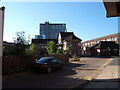
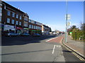
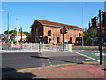
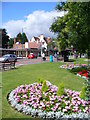
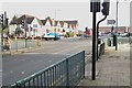
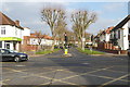
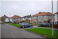
Photos of KT6 7EN


Area Information
Living in KT6 7EN means being part of a small, tightly knit residential cluster in south London, where the population of 1990 residents reflects a quiet, established community. The area is defined by its modest scale, with homes primarily built for families and individuals seeking a stable, low-maintenance lifestyle. The median age of 47 suggests a mature demographic, with most residents falling between 30 and 64 years old. This makes KT6 7EN a place where daily life is shaped by routine, with a focus on local amenities and proximity to transport links. The postcode’s compact nature means that residents are likely to know their neighbours, and the area’s character is defined by its balance of residential tranquillity and practical connectivity. For those considering homes in KT6 7EN, the appeal lies in its simplicity: a place where the pace of life is unhurried, and the essentials of living—shopping, schooling, and transport—are all within reach without the need for long commutes.
- Area Type
- Postcode
- Area Size
- Not available
- Population
- 1990
- Population Density
- 2594 people/km²
The property market in KT6 7EN is characterised by a 44% home ownership rate, which indicates that nearly half of the properties are owner-occupied, while the remaining are likely to be rented out. The accommodation type is predominantly houses, which is notable in an area where flats are often the norm in urban settings. This suggests a housing stock that prioritises private space and garden access, appealing to families or individuals who prefer the layout and seclusion of a house. Given the small size of the area, the property market is unlikely to be highly competitive, with limited scope for new developments. Buyers should consider that the owner-occupied nature of many homes may mean fewer rental options, though the presence of a 44% ownership rate also implies a stable market with properties held long-term. For those seeking homes in KT6 7EN, the focus should be on existing stock rather than speculative growth, with an emphasis on practicality and location.
House Prices in KT6 7EN
No properties found in this postcode.
Energy Efficiency in KT6 7EN
Residents of KT6 7EN have access to a range of amenities that support both daily needs and leisure activities. The retail sector includes major stores such as Tesco Tolworth, Iceland Tolworth, and M&S Tolworth, offering everything from groceries to clothing. For transport, the area is served by rail stations like Tolworth and Berrylands, as well as ferry services at Kingston Town End Pier, enabling easy travel to nearby locations. Metro stops such as Morden and Dundonald Road Tram Stop provide additional connectivity to surrounding areas. The presence of these amenities ensures that residents can meet their shopping, commuting, and recreational needs without venturing far. The combination of retail options, transport links, and proximity to water-based travel options contributes to a lifestyle that balances convenience with accessibility, making KT6 7EN a practical choice for those prioritising ease of movement and local facilities.
Amenities
Schools
The nearest school to KT6 7EN is Knollmead Primary School, which serves the local community with primary education. The school holds an Ofsted rating of outstanding, a testament to its quality of teaching and student outcomes. As a primary school, it caters to children aged 4 to 11, making it a central institution for families in the area. The absence of secondary schools within the data suggests that students may need to travel to nearby districts for further education, though the outstanding rating of Knollmead ensures a strong foundation for early learning. For parents prioritising educational quality, the presence of a high-performing primary school is a significant advantage. The school’s status also implies that the area is likely to attract families seeking reliable schooling, though the limited range of educational institutions may require planning for secondary education options beyond KT6 7EN.
| Rank | School | Type | Entry gender | Ages |
|---|
Explore more schools in this area
Go to Schools tabDemographics
The community in KT6 7EN is predominantly composed of adults aged 30 to 64, with a median age of 47. This age range suggests a population focused on family life, career stability, and long-term residency. Home ownership stands at 44%, indicating a mix of owner-occupied properties and rental units, though the accommodation type is primarily houses rather than flats. The predominant ethnic group is White, which aligns with the broader demographic trends of the surrounding area. While specific data on deprivation is not provided, the age profile and home ownership figures suggest a relatively stable socioeconomic environment. The absence of significant diversity metrics means the community is likely homogenous in composition, though this does not necessarily reflect a lack of inclusivity. For residents, the demographic makeup translates to a neighbourhood where social interactions are likely to be familiar and predictable, with a focus on local institutions and services.
Household Size
Accommodation Type
Tenure
Ethnic Group
Religion
Household Composition
Age
Household Deprivation
NS-SEC
Explore more demographic insights in this area
Go to Demographics tabPlanning
Planning Constraints
- Flood RiskPremium
- Ramsar Wetland SitesPremium
- Area of Outstanding Natural BeautyPremium
- Protected Nature ReservePremium
- Protected WoodlandPremium