Area Overview for KT6 7DU
Photos of KT6 7DU
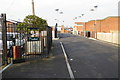
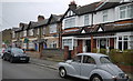
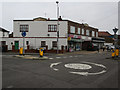
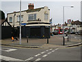


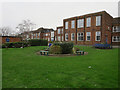

53 photos from this area
Area Information
Key information about the KT6 7DU including its size, population, and administrative classification.
- Area Type
- Postcode
- Area Size
- 7381 m²
- Population
- 1870
- Population Density
- 1630 people/km²
House Prices in KT6 7DU
46
Properties
£573,632
Average Sold Price
£500,000
Lowest Price
£650,000
Highest Price
Showing 46 properties
| Address | Type | Beds | Baths | Last Sale Price | Last Sale Date | |
|---|---|---|---|---|---|---|
| 33 Tala Close, Tolworth, KT6 7DU | Terraced | 3 | 2 | £605,000 | Jun 2025 | |
| 39 Tala Close, Tolworth, KT6 7DU | Retail | 4 | 2 | £650,000 | Mar 2023 | |
| 43 Tala Close, Tolworth, KT6 7DU | Terraced | 3 | 2 | £530,000 | Jan 2021 | |
| 45 Tala Close, Tolworth, KT6 7DU | house | - | - | £600,000 | May 2019 | |
| 41 Tala Close, Tolworth, KT6 7DU | house | - | - | £554,950 | Apr 2019 | |
| 27 Tala Close, Tolworth, KT6 7DU | Terraced | 4 | 2 | £575,000 | Mar 2019 | |
| 37 Tala Close, Tolworth, KT6 7DU | house | - | - | £600,000 | Mar 2019 | |
| 35 Tala Close, Tolworth, KT6 7DU | house | - | - | £564,950 | Mar 2019 | |
| 31 Tala Close, Tolworth, KT6 7DU | house | - | - | £600,000 | Mar 2019 | |
| 29 Tala Close, Tolworth, KT6 7DU | house | - | - | £600,000 | Mar 2019 |
Page 1 of 5
Energy Efficiency in KT6 7DU
Amenities
Schools
| Rank | School | Type | Entry gender | Ages |
|---|
Explore more schools in this area
Go to Schools tabDemographics
Household Size
Family (3-5 people)
most common
Accommodation Type
Houses
most common
Tenure
69
majority
Ethnic Group
White
most common
Religion
N/A
most common
Household Composition
N/A
most common
Age
47
median
Adults (30-64 years)
most common
Household Deprivation
N/A
with no deprivation
NS-SEC
37
in Lower managerial occupations
Explore more demographic insights in this area
Go to Demographics tabPlanning
Planning Constraints
- Flood RiskPremium
- Ramsar Wetland SitesPremium
- Area of Outstanding Natural BeautyPremium
- Protected Nature ReservePremium
- Protected WoodlandPremium