Area Overview for KT6 6DY
Photos of KT6 6DY


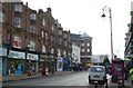

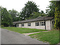


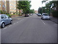
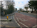
100 photos from this area
Area Information
Key information about the KT6 6DY including its size, population, and administrative classification.
- Area Type
- Postcode
- Area Size
- 1.8 hectares
- Population
- 1535
- Population Density
- 8105 people/km²
House Prices in KT6 6DY
72
Properties
£375,741
Average Sold Price
£86,200
Lowest Price
£935,000
Highest Price
Showing 72 properties
| Address | Type | Beds | Baths | Last Sale Price | Last Sale Date | |
|---|---|---|---|---|---|---|
| 1 Oak Hill, Surbiton, KT6 6DY | Maisonette | 2 | 1 | £742,500 | Jul 2025 | |
| 61 Oak Hill, Surbiton, KT6 6DY | Flat | - | - | £350,000 | Jul 2024 | |
| 28 Oak Hill, Surbiton, KT6 6DY | Flat | - | - | £350,000 | Jun 2023 | |
| 20 Oak Hill, Surbiton, KT6 6DY | Maisonette | 2 | - | £400,000 | Apr 2023 | |
| 24 Oak Hill, Surbiton, KT6 6DY | Flat | 2 | 1 | £420,000 | Apr 2022 | |
| 18 Oak Hill, Surbiton, KT6 6DY | Flat | - | - | £385,000 | Nov 2021 | |
| 43 Oak Hill, Surbiton, KT6 6DY | house | - | - | £700,000 | Nov 2020 | |
| 39 Oak Hill, Surbiton, KT6 6DY | Semi-detached | 5 | 2 | £935,000 | Oct 2020 | |
| 57 Oak Hill, Surbiton, KT6 6DY | Flat | - | - | £397,500 | Sep 2018 | |
| 59 Oak Hill, Surbiton, KT6 6DY | Flat | 2 | 1 | £415,000 | Jul 2017 |
Page 1 of 8
Energy Efficiency in KT6 6DY
Amenities
Schools
| Rank | School | Type | Entry gender | Ages |
|---|
Explore more schools in this area
Go to Schools tabDemographics
Household Size
One person
most common
Accommodation Type
Flats
most common
Tenure
37
majority
Ethnic Group
White
most common
Religion
N/A
most common
Household Composition
N/A
most common
Age
47
median
Adults (30-64 years)
most common
Household Deprivation
N/A
with no deprivation
NS-SEC
52
in Lower managerial occupations
Explore more demographic insights in this area
Go to Demographics tabPlanning
Planning Constraints
- Flood RiskPremium
- Ramsar Wetland SitesPremium
- Area of Outstanding Natural BeautyPremium
- Protected Nature ReservePremium
- Protected WoodlandPremium