Area Overview for KT6 5BS
Photos of KT6 5BS
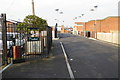
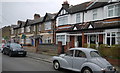
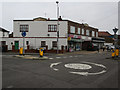
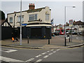


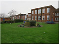
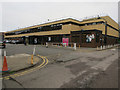
53 photos from this area
Area Information
Key information about the KT6 5BS including its size, population, and administrative classification.
- Area Type
- Postcode
- Area Size
- 6874 m²
- Population
- 1507
- Population Density
- 4720 people/km²
House Prices in KT6 5BS
28
Properties
£320,818
Average Sold Price
£62,000
Lowest Price
£472,000
Highest Price
Showing 28 properties
| Address | Type | Beds | Baths | Last Sale Price | Last Sale Date | |
|---|---|---|---|---|---|---|
| 46 Shrewsbury Close, Tolworth, KT6 5BS | Maisonette | 2 | 1 | £472,000 | Jul 2025 | |
| 44 Shrewsbury Close, Tolworth, KT6 5BS | Maisonette | 3 | 2 | £425,000 | Jan 2024 | |
| 8 Shrewsbury Close, Tolworth, KT6 5BS | Maisonette | 2 | 1 | £395,000 | Dec 2023 | |
| 18 Shrewsbury Close, Tolworth, KT6 5BS | Maisonette | 2 | 1 | £440,000 | Oct 2022 | |
| 50 Shrewsbury Close, Tolworth, KT6 5BS | Flat | 2 | 1 | £405,000 | Jul 2022 | |
| 34 Shrewsbury Close, Tolworth, KT6 5BS | Maisonette | - | - | £410,000 | Sep 2021 | |
| 10 Shrewsbury Close, Tolworth, KT6 5BS | Maisonette | 2 | 1 | £417,000 | Sep 2020 | |
| 14 Shrewsbury Close, Tolworth, KT6 5BS | Flat | 2 | 1 | £352,000 | Nov 2018 | |
| 4 Shrewsbury Close, Tolworth, KT6 5BS | Maisonette | 2 | 1 | £390,000 | Jul 2017 | |
| 12 Shrewsbury Close, Tolworth, KT6 5BS | Flat | - | - | £375,000 | Jun 2017 |
Page 1 of 3
Energy Efficiency in KT6 5BS
Amenities
Schools
| Rank | School | Type | Entry gender | Ages |
|---|
Explore more schools in this area
Go to Schools tabDemographics
Household Size
Family (3-5 people)
most common
Accommodation Type
Houses
most common
Tenure
69
majority
Ethnic Group
White
most common
Religion
N/A
most common
Household Composition
N/A
most common
Age
47
median
Adults (30-64 years)
most common
Household Deprivation
N/A
with no deprivation
NS-SEC
56
in Lower managerial occupations
Explore more demographic insights in this area
Go to Demographics tabPlanning
Planning Constraints
- Flood RiskPremium
- Ramsar Wetland SitesPremium
- Area of Outstanding Natural BeautyPremium
- Protected Nature ReservePremium
- Protected WoodlandPremium