Area Overview for KT6 4LJ
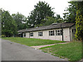
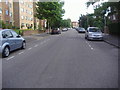
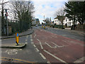
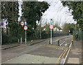
Photos of KT6 4LJ


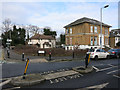
Area Information
KT6 4LJ is a small, densely populated residential postcode in England, covering just 1,255 square metres and home to 1,895 residents. Its compact size means the area feels intimate, with a high population density of over 1.5 million people per square kilometre. This postcode is characterised by a cluster of flats, reflecting its urban nature and the predominance of rental properties. Daily life here is shaped by proximity to amenities, with a mix of retail, transport, and leisure options within reach. The area’s demographics suggest a mature population, with a median age of 47 and most residents falling within the 30–64 age range. While the community is largely White, the data does not indicate significant ethnic diversity. Living in KT6 4LJ offers convenience for those prioritising accessibility to shops, schools, and transport networks, though the high population density may influence the pace of life. The area’s proximity to Kingston and surrounding towns adds to its practical appeal, though buyers should consider the implications of its compact footprint.
- Area Type
- Postcode
- Area Size
- 1255 m²
- Population
- 1895
- Population Density
- 8918 people/km²
The property market in KT6 4LJ is heavily rental-focused, with only 33% of homes owner-occupied. Flats dominate the housing stock, which is typical for high-density urban areas. This suggests limited availability of larger properties or detached homes, which may appeal more to families or those seeking spacious living. The small area size and high population density mean the market is tightly concentrated, with little scope for expansion. Buyers should consider the implications of living in a predominantly rental area—potentially higher competition for owner-occupied properties and a focus on short-term lettings. For those seeking flats, the area offers proximity to transport and amenities, but the compact nature of KT6 4LJ means buyers must weigh the benefits of convenience against the limitations of space.
House Prices in KT6 4LJ
No properties found in this postcode.
Energy Efficiency in KT6 4LJ
Living in KT6 4LJ offers access to a range of amenities within practical reach. Retail options include major supermarkets such as Waitrose Surbiton, Morrisons Daily, and Sainsburys Surbiton, ensuring convenience for grocery shopping. The area’s proximity to ferry services like Kingston Town End Pier and Ditton Island Landing adds a unique dimension to local transport and leisure. Rail and metro stations, including Berrylands Railway Station and Dundonald Road Tram Stop, provide easy access to surrounding towns. While the data does not detail parks or leisure facilities, the presence of multiple transport and retail hubs suggests a focus on practicality over expansive green spaces. The compact nature of KT6 4LJ means residents rely on nearby hubs for dining, shopping, and socialising, creating a tightly connected community with a strong emphasis on accessibility.
Amenities
Schools
KT6 4LJ is served by two primary schools: Maple Infants’ School, rated ‘good’ by Ofsted, and St Andrew’s and St Mark’s CofE Junior School, which holds an ‘outstanding’ rating. Both institutions are within practical reach, offering families a choice of educational settings. The presence of a Church of England school alongside a non-denominational primary reflects a mix of educational philosophies. For parents, this diversity may be advantageous, allowing selection based on curriculum preferences or religious alignment. The ‘outstanding’ rating at St Andrew’s and St Mark’s indicates high standards of teaching and outcomes, which could be a key draw for families prioritising academic excellence. However, no secondary schools are listed in the data, so parents may need to consider commuting for older children.
| Rank | School | Type | Entry gender | Ages |
|---|
Explore more schools in this area
Go to Schools tabDemographics
The community in KT6 4LJ is predominantly middle-aged, with a median age of 47 and most residents falling within the 30–64 age range. Home ownership is relatively low, at 33%, suggesting a rental market dominates. Flats are the primary accommodation type, reflecting the area’s urban character. The predominant ethnic group is White, though no specific data on diversity or deprivation levels is provided. The high population density—over 1.5 million people per square kilometre—indicates a compact, possibly mixed-use environment. For quality of life, this density may mean limited private outdoor space but strong local amenities. The data does not specify income levels or deprivation metrics, so it is unclear how economic factors influence daily living. However, the presence of multiple schools and transport links suggests efforts to balance urban living with essential services.
Household Size
Accommodation Type
Tenure
Ethnic Group
Religion
Household Composition
Age
Household Deprivation
NS-SEC
Explore more demographic insights in this area
Go to Demographics tabPlanning
Planning Constraints
- Flood RiskPremium
- Ramsar Wetland SitesPremium
- Area of Outstanding Natural BeautyPremium
- Protected Nature ReservePremium
- Protected WoodlandPremium