Area Overview for KT5 9JN
Photos of KT5 9JN
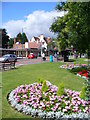
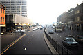
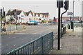
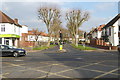
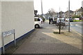

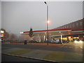
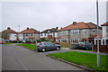
82 photos from this area
Area Information
Key information about the KT5 9JN including its size, population, and administrative classification.
- Area Type
- Postcode
- Area Size
- 1.8 hectares
- Population
- 1478
- Population Density
- 3361 people/km²
House Prices in KT5 9JN
26
Properties
£495,188
Average Sold Price
£137,000
Lowest Price
£855,000
Highest Price
Showing 26 properties
| Address | Type | Beds | Baths | Last Sale Price | Last Sale Date | |
|---|---|---|---|---|---|---|
| 54 Elgar Avenue, Surbiton, KT5 9JN | Semi-detached | 3 | 1 | £855,000 | Oct 2024 | |
| 44 Elgar Avenue, Surbiton, KT5 9JN | Semi-detached | 3 | 1 | £720,000 | Apr 2024 | |
| 46 Elgar Avenue, Surbiton, KT5 9JN | Semi-detached | 4 | 1 | £780,000 | May 2023 | |
| 60 Elgar Avenue, Surbiton, KT5 9JN | Semi-detached | 3 | - | £635,000 | Jan 2021 | |
| 80 Elgar Avenue, Surbiton, KT5 9JN | Semi-detached | 5 | 2 | £750,000 | Jan 2020 | |
| 62 Elgar Avenue, Surbiton, KT5 9JN | house | - | - | £625,000 | Aug 2019 | |
| 82 Elgar Avenue, Surbiton, KT5 9JN | Maisonette | 2 | 1 | £432,000 | Jul 2016 | |
| 68 Elgar Avenue, Surbiton, KT5 9JN | house | - | - | £550,000 | Dec 2010 | |
| 70 Elgar Avenue, Surbiton, KT5 9JN | house | - | - | £385,000 | Sep 2009 | |
| 74 Elgar Avenue, Surbiton, KT5 9JN | Semi-detached | - | - | £475,000 | Apr 2008 |
Page 1 of 3
Energy Efficiency in KT5 9JN
Amenities
Schools
| Rank | School | Type | Entry gender | Ages |
|---|
Explore more schools in this area
Go to Schools tabDemographics
Household Size
Family (3-5 people)
most common
Accommodation Type
Houses
most common
Tenure
85
majority
Ethnic Group
White
most common
Religion
N/A
most common
Household Composition
N/A
most common
Age
47
median
Adults (30-64 years)
most common
Household Deprivation
N/A
with no deprivation
NS-SEC
45
in Lower managerial occupations
Explore more demographic insights in this area
Go to Demographics tabPlanning
Planning Constraints
- Flood RiskPremium
- Ramsar Wetland SitesPremium
- Area of Outstanding Natural BeautyPremium
- Protected Nature ReservePremium
- Protected WoodlandPremium