Area Overview for KT5 9EN
Photos of KT5 9EN
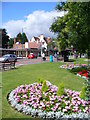

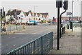
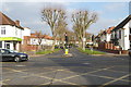
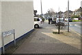


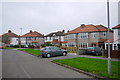
82 photos from this area
Area Information
Key information about the KT5 9EN including its size, population, and administrative classification.
- Area Type
- Postcode
- Area Size
- 1.3 hectares
- Population
- 1990
- Population Density
- 2594 people/km²
House Prices in KT5 9EN
24
Properties
£274,876
Average Sold Price
£91,000
Lowest Price
£585,000
Highest Price
Showing 24 properties
| Address | Type | Beds | Baths | Last Sale Price | Last Sale Date | |
|---|---|---|---|---|---|---|
| 67 Tolworth Rise North, Tolworth, KT5 9EN | Semi-detached | 3 | 1 | £585,000 | Mar 2025 | |
| 65 Tolworth Rise North, Tolworth, KT5 9EN | Semi-detached | 3 | 1 | £378,000 | Dec 2019 | |
| 39 Tolworth Rise North, Tolworth, KT5 9EN | Semi-detached | 3 | 1 | £495,000 | Sep 2018 | |
| 57 Tolworth Rise North, Tolworth, KT5 9EN | Semi-detached | 5 | 4 | £399,950 | Aug 2014 | |
| 33 Tolworth Rise North, Tolworth, KT5 9EN | house | 2 | 1 | £225,000 | Sep 2012 | |
| 75 Tolworth Rise North, Tolworth, KT5 9EN | house | - | - | £261,000 | Oct 2010 | |
| 59 Tolworth Rise North, Tolworth, KT5 9EN | Semi-detached | - | - | £250,000 | Oct 2008 | |
| 41 Tolworth Rise North, Tolworth, KT5 9EN | Semi-detached | - | - | £271,000 | Aug 2007 | |
| 69 Tolworth Rise North, Tolworth, KT5 9EN | house | - | - | £241,000 | Feb 2007 | |
| 49 Tolworth Rise North, Tolworth, KT5 9EN | Semi-detached | - | - | £249,950 | Dec 2006 |
Page 1 of 3
Energy Efficiency in KT5 9EN
Amenities
Schools
| Rank | School | Type | Entry gender | Ages |
|---|
Explore more schools in this area
Go to Schools tabDemographics
Household Size
Family (3-5 people)
most common
Accommodation Type
Houses
most common
Tenure
44
majority
Ethnic Group
White
most common
Religion
N/A
most common
Household Composition
N/A
most common
Age
47
median
Adults (30-64 years)
most common
Household Deprivation
N/A
with no deprivation
NS-SEC
28
in Lower managerial occupations
Explore more demographic insights in this area
Go to Demographics tabPlanning
Planning Constraints
- Flood RiskPremium
- Ramsar Wetland SitesPremium
- Area of Outstanding Natural BeautyPremium
- Protected Nature ReservePremium
- Protected WoodlandPremium