Area Overview for KT5 9DD
Photos of KT5 9DD
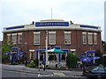
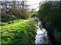
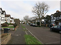
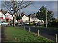
58 photos from this area
Area Information
Key information about the KT5 9DD including its size, population, and administrative classification.
- Area Type
- Postcode
- Area Size
- 6242 m²
- Population
- 1546
- Population Density
- 4742 people/km²
House Prices in KT5 9DD
12
Properties
£452,000
Average Sold Price
£134,000
Lowest Price
£810,000
Highest Price
Showing 12 properties
| Address | Type | Beds | Baths | Last Sale Price | Last Sale Date | |
|---|---|---|---|---|---|---|
| 145 Raeburn Avenue, Tolworth, KT5 9DD | Semi-detached | 4 | - | £750,000 | Nov 2018 | |
| 131 Raeburn Avenue, Tolworth, KT5 9DD | Semi-detached | 4 | 3 | £810,000 | May 2017 | |
| 137 Raeburn Avenue, Tolworth, KT5 9DD | Detached | 4 | - | £615,000 | Dec 2013 | |
| 151 Raeburn Avenue, Tolworth, KT5 9DD | house | 3 | - | £424,000 | Feb 2012 | |
| 139 Raeburn Avenue, Tolworth, KT5 9DD | Semi-detached | - | - | £397,500 | Jul 2005 | |
| 149 Raeburn Avenue, Tolworth, KT5 9DD | Detached | - | - | £370,000 | Oct 2002 | |
| 143 Raeburn Avenue, Tolworth, KT5 9DD | house | - | - | £270,000 | Jul 2002 | |
| 135 Raeburn Avenue, Tolworth, KT5 9DD | house | - | - | £297,500 | Nov 2001 | |
| 153 Raeburn Avenue, Tolworth, KT5 9DD | house | - | - | £134,000 | Jun 1996 | |
| 147 Raeburn Avenue, Tolworth, KT5 9DD | Detached | - | - | - | - |
Page 1 of 2
Energy Efficiency in KT5 9DD
Amenities
Schools
| Rank | School | Type | Entry gender | Ages |
|---|
Explore more schools in this area
Go to Schools tabDemographics
Household Size
Family (3-5 people)
most common
Accommodation Type
Houses
most common
Tenure
90
majority
Ethnic Group
White
most common
Religion
N/A
most common
Household Composition
N/A
most common
Age
47
median
Adults (30-64 years)
most common
Household Deprivation
N/A
with no deprivation
NS-SEC
58
in Lower managerial occupations
Explore more demographic insights in this area
Go to Demographics tabPlanning
Planning Constraints
- Flood RiskPremium
- Ramsar Wetland SitesPremium
- Area of Outstanding Natural BeautyPremium
- Protected Nature ReservePremium
- Protected WoodlandPremium