Area Overview for KT5 9AA
Photos of KT5 9AA
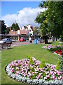

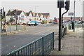
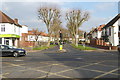
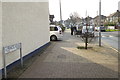

82 photos from this area
Area Information
Key information about the KT5 9AA including its size, population, and administrative classification.
- Area Type
- Postcode
- Area Size
- 3.5 hectares
- Population
- 1478
- Population Density
- 3361 people/km²
House Prices in KT5 9AA
22
Properties
£719,700
Average Sold Price
£125,500
Lowest Price
£1,000,000
Highest Price
Showing 22 properties
| Address | Type | Beds | Baths | Last Sale Price | Last Sale Date | |
|---|---|---|---|---|---|---|
| 1 Alexandra Drive, Surbiton, KT5 9AA | Semi-detached | 4 | 1 | £915,000 | Jan 2024 | |
| 6 Alexandra Drive, Surbiton, KT5 9AA | house | - | - | £910,000 | Aug 2021 | |
| 9 Alexandra Drive, Surbiton, KT5 9AA | house | - | - | £1,000,000 | Nov 2020 | |
| 17 Alexandra Drive, Surbiton, KT5 9AA | Semi-detached | 5 | 4 | £990,500 | Dec 2018 | |
| 11 Alexandra Drive, Surbiton, KT5 9AA | Detached | 4 | 1 | £985,000 | Aug 2017 | |
| 3 Alexandra Drive, Surbiton, KT5 9AA | Detached | 4 | 2 | £932,000 | Nov 2015 | |
| 13 Alexandra Drive, Surbiton, KT5 9AA | Detached | - | - | £780,000 | Apr 2007 | |
| 2 Alexandra Drive, Surbiton, KT5 9AA | Semi-detached | - | - | £417,000 | Apr 2003 | |
| 16 Alexandra Drive, Surbiton, KT5 9AA | Semi-detached | - | - | £142,000 | Apr 1995 | |
| 14 Alexandra Drive, Surbiton, KT5 9AA | Semi-detached | - | - | £125,500 | Mar 1995 |
Page 1 of 3
Energy Efficiency in KT5 9AA
Amenities
Schools
| Rank | School | Type | Entry gender | Ages |
|---|
Explore more schools in this area
Go to Schools tabDemographics
Household Size
Family (3-5 people)
most common
Accommodation Type
Houses
most common
Tenure
85
majority
Ethnic Group
White
most common
Religion
N/A
most common
Household Composition
N/A
most common
Age
47
median
Adults (30-64 years)
most common
Household Deprivation
N/A
with no deprivation
NS-SEC
45
in Lower managerial occupations
Explore more demographic insights in this area
Go to Demographics tabPlanning
Planning Constraints
- Flood RiskPremium
- Ramsar Wetland SitesPremium
- Area of Outstanding Natural BeautyPremium
- Protected Nature ReservePremium
- Protected WoodlandPremium