Area Overview for KT5 8PY
Photos of KT5 8PY
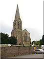
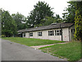
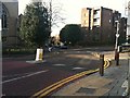
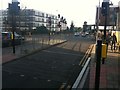
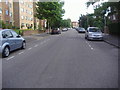
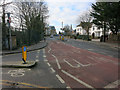
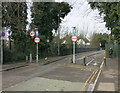
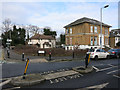
100 photos from this area
Area Information
Key information about the KT5 8PY including its size, population, and administrative classification.
- Area Type
- Postcode
- Area Size
- 1.0 hectares
- Population
- 1727
- Population Density
- 10035 people/km²
House Prices in KT5 8PY
49
Properties
£610,745
Average Sold Price
£180,000
Lowest Price
£935,000
Highest Price
Showing 49 properties
| Address | Type | Beds | Baths | Last Sale Price | Last Sale Date | |
|---|---|---|---|---|---|---|
| 12 King Charles Road, Surbiton, KT5 8PY | Semi-detached | 4 | 3 | £865,000 | Jan 2025 | |
| 16 King Charles Road, Surbiton, KT5 8PY | house | - | - | £820,000 | Feb 2022 | |
| 20 King Charles Road, Surbiton, KT5 8PY | house | 3 | - | £935,000 | Nov 2015 | |
| 36 King Charles Road, Surbiton, KT5 8PY | house | - | - | £785,000 | Dec 2012 | |
| 18 King Charles Road, Surbiton, KT5 8PY | Semi-detached | 4 | 2 | £675,000 | Jun 2011 | |
| 8 King Charles Road, Surbiton, KT5 8PY | house | 4 | - | £738,000 | Jun 2011 | |
| 10 King Charles Road, Surbiton, KT5 8PY | house | - | - | £495,000 | Jul 2006 | |
| 40 King Charles Road, Surbiton, KT5 8PY | Detached | 4 | 3 | £299,950 | Apr 2003 | |
| 22 King Charles Road, Surbiton, KT5 8PY | Semi-detached | 3 | 1 | £314,500 | Apr 2003 | |
| 4 King Charles Road, Surbiton, KT5 8PY | Flat | 1 | 1 | £180,000 | Feb 1998 |
Page 1 of 5
Energy Efficiency in KT5 8PY
Amenities
Schools
| Rank | School | Type | Entry gender | Ages |
|---|
Explore more schools in this area
Go to Schools tabDemographics
Household Size
One person
most common
Accommodation Type
Flats
most common
Tenure
34
majority
Ethnic Group
White
most common
Religion
N/A
most common
Household Composition
N/A
most common
Age
47
median
Adults (30-64 years)
most common
Household Deprivation
N/A
with no deprivation
NS-SEC
48
in Lower managerial occupations
Explore more demographic insights in this area
Go to Demographics tabPlanning
Planning Constraints
- Flood RiskPremium
- Ramsar Wetland SitesPremium
- Area of Outstanding Natural BeautyPremium
- Protected Nature ReservePremium
- Protected WoodlandPremium