Area Overview for KT5 8PW
Photos of KT5 8PW
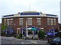
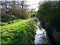
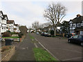
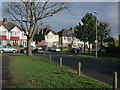
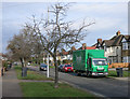
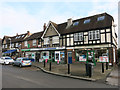
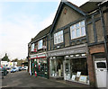
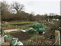
58 photos from this area
Area Information
Key information about the KT5 8PW including its size, population, and administrative classification.
- Area Type
- Postcode
- Area Size
- 1.3 hectares
- Population
- 1546
- Population Density
- 4742 people/km²
House Prices in KT5 8PW
29
Properties
£574,809
Average Sold Price
£235,000
Lowest Price
£920,000
Highest Price
Showing 29 properties
| Address | Type | Beds | Baths | Last Sale Price | Last Sale Date | |
|---|---|---|---|---|---|---|
| 63 Queens Drive, Surbiton, KT5 8PW | Semi-detached | 3 | 1 | £699,950 | Aug 2024 | |
| 55 Queens Drive, Surbiton, KT5 8PW | Bungalow | 3 | 2 | £800,000 | Mar 2023 | |
| 34 Queens Drive, Surbiton, KT5 8PW | Semi-detached | 3 | 1 | £715,000 | Mar 2020 | |
| 37 Queens Drive, Surbiton, KT5 8PW | Detached | 5 | 5 | £905,000 | Jan 2019 | |
| 57 Queens Drive, Surbiton, KT5 8PW | Bungalow | 2 | 1 | £610,000 | Nov 2018 | |
| 41 Queens Drive, Surbiton, KT5 8PW | Bungalow | 3 | 1 | £620,000 | Oct 2018 | |
| 53 Queens Drive, Surbiton, KT5 8PW | Bungalow | 2 | 1 | £695,000 | Jun 2017 | |
| 48 Queens Drive, Surbiton, KT5 8PW | Semi-detached | 3 | 1 | £795,000 | Jul 2015 | |
| 52 Queens Drive, Surbiton, KT5 8PW | Semi-detached | 3 | - | £671,000 | Apr 2015 | |
| 46 Queens Drive, Surbiton, KT5 8PW | Semi-detached | 5 | - | £920,000 | Jan 2015 |
Page 1 of 3
Energy Efficiency in KT5 8PW
Amenities
Schools
| Rank | School | Type | Entry gender | Ages |
|---|
Explore more schools in this area
Go to Schools tabDemographics
Household Size
Family (3-5 people)
most common
Accommodation Type
Houses
most common
Tenure
90
majority
Ethnic Group
White
most common
Religion
N/A
most common
Household Composition
N/A
most common
Age
47
median
Adults (30-64 years)
most common
Household Deprivation
N/A
with no deprivation
NS-SEC
58
in Lower managerial occupations
Explore more demographic insights in this area
Go to Demographics tabPlanning
Planning Constraints
- Flood RiskPremium
- Ramsar Wetland SitesPremium
- Area of Outstanding Natural BeautyPremium
- Protected Nature ReservePremium
- Protected WoodlandPremium