Area Overview for KT5 8DX
Photos of KT5 8DX

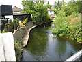
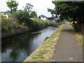
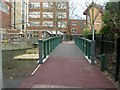
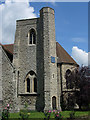
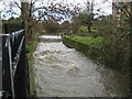
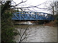
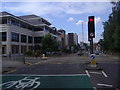
100 photos from this area
Area Information
Key information about the KT5 8DX including its size, population, and administrative classification.
- Area Type
- Postcode
- Area Size
- 5055 m²
- Population
- 1568
- Population Density
- 4752 people/km²
House Prices in KT5 8DX
27
Properties
£206,762
Average Sold Price
£60,000
Lowest Price
£333,500
Highest Price
Showing 27 properties
| Address | Type | Beds | Baths | Last Sale Price | Last Sale Date | |
|---|---|---|---|---|---|---|
| 42 Minstrel Gardens, Surbiton, KT5 8DX | Flat | - | - | £275,000 | Mar 2024 | |
| 51 Minstrel Gardens, Surbiton, KT5 8DX | Flat | - | - | £280,000 | Mar 2024 | |
| 37 Minstrel Gardens, Surbiton, KT5 8DX | Flat | 1 | 1 | £280,000 | Sep 2023 | |
| 50 Minstrel Gardens, Surbiton, KT5 8DX | Flat | - | - | £333,500 | Mar 2023 | |
| 52 Minstrel Gardens, Surbiton, KT5 8DX | Flat | 1 | 1 | £277,500 | Oct 2022 | |
| 36 Minstrel Gardens, Surbiton, KT5 8DX | Flat | 1 | 1 | £270,000 | Apr 2022 | |
| 47 Minstrel Gardens, Surbiton, KT5 8DX | Flat | 1 | 1 | £260,000 | Nov 2021 | |
| 58 Minstrel Gardens, Surbiton, KT5 8DX | Flat | 1 | 1 | £251,000 | Mar 2020 | |
| 40 Minstrel Gardens, Surbiton, KT5 8DX | Flat | - | - | £277,500 | Mar 2020 | |
| 49 Minstrel Gardens, Surbiton, KT5 8DX | Flat | - | - | £279,162 | Apr 2019 |
Page 1 of 3
Energy Efficiency in KT5 8DX
Amenities
Schools
| Rank | School | Type | Entry gender | Ages |
|---|
Explore more schools in this area
Go to Schools tabDemographics
Household Size
Family (3-5 people)
most common
Accommodation Type
Houses
most common
Tenure
61
majority
Ethnic Group
White
most common
Religion
N/A
most common
Household Composition
N/A
most common
Age
22
median
Young Adults (15-29 years)
most common
Household Deprivation
N/A
with no deprivation
NS-SEC
32
in Lower managerial occupations
Explore more demographic insights in this area
Go to Demographics tabPlanning
Planning Constraints
- Flood RiskPremium
- Ramsar Wetland SitesPremium
- Area of Outstanding Natural BeautyPremium
- Protected Nature ReservePremium
- Protected WoodlandPremium