Area Overview for KT5 8DF
Photos of KT5 8DF
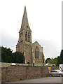
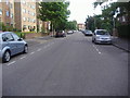
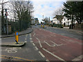
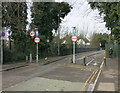
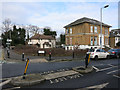
100 photos from this area
Area Information
Key information about the KT5 8DF including its size, population, and administrative classification.
- Area Type
- Postcode
- Area Size
- 4.4 hectares
- Population
- 1568
- Population Density
- 4752 people/km²
House Prices in KT5 8DF
100
Properties
£518,967
Average Sold Price
£78,000
Lowest Price
£1,220,000
Highest Price
Showing 100 properties (first 250)
| Address | Type | Beds | Baths | Last Sale Price | Last Sale Date | |
|---|---|---|---|---|---|---|
| 3A Burney Avenue, Surbiton, KT5 8DF | Terraced | 6 | 3 | £728,834 | Aug 2022 | |
| 79 Burney Avenue, Surbiton, KT5 8DF | Semi-detached | 3 | 1 | £780,000 | Jul 2022 | |
| 11A Burney Avenue, Surbiton, KT5 8DF | house | - | - | £824,000 | Dec 2021 | |
| 7 Burney Avenue, Surbiton, KT5 8DF | house | - | - | £1,220,000 | Dec 2021 | |
| 41 Burney Avenue, Surbiton, KT5 8DF | house | 3 | - | £638,000 | May 2021 | |
| 69 Burney Avenue, Surbiton, KT5 8DF | Semi-detached | 6 | 3 | £488,000 | Mar 2021 | |
| 71 Burney Avenue, Surbiton, KT5 8DF | Semi-detached | 4 | 2 | £492,500 | Jun 2020 | |
| 29 Burney Avenue, Surbiton, KT5 8DF | Semi-detached | 3 | 1 | £530,000 | Oct 2018 | |
| 3C Burney Avenue, Surbiton, KT5 8DF | Terraced | 4 | 2 | £565,000 | Dec 2017 | |
| 15 Burney Avenue, Surbiton, KT5 8DF | Semi-detached | 6 | 3 | £805,000 | Feb 2017 |
Page 1 of 10
Energy Efficiency in KT5 8DF
Amenities
Schools
| Rank | School | Type | Entry gender | Ages |
|---|
Explore more schools in this area
Go to Schools tabDemographics
Household Size
Family (3-5 people)
most common
Accommodation Type
Houses
most common
Tenure
61
majority
Ethnic Group
White
most common
Religion
N/A
most common
Household Composition
N/A
most common
Age
22
median
Young Adults (15-29 years)
most common
Household Deprivation
N/A
with no deprivation
NS-SEC
32
in Lower managerial occupations
Explore more demographic insights in this area
Go to Demographics tabPlanning
Planning Constraints
- Flood RiskPremium
- Ramsar Wetland SitesPremium
- Area of Outstanding Natural BeautyPremium
- Protected Nature ReservePremium
- Protected WoodlandPremium