Area Overview for KT4 8TL
Photos of KT4 8TL

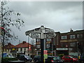

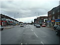
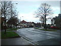

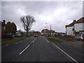
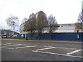
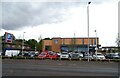
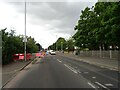
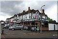
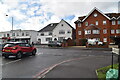
47 photos from this area
Area Information
Key information about the KT4 8TL including its size, population, and administrative classification.
- Area Type
- Postcode
- Area Size
- 3841 m²
- Population
- 1810
- Population Density
- 6669 people/km²
House Prices in KT4 8TL
19
Properties
£191,269
Average Sold Price
£40,000
Lowest Price
£390,000
Highest Price
Showing 19 properties
| Address | Type | Beds | Baths | Last Sale Price | Last Sale Date | |
|---|---|---|---|---|---|---|
| 9A Cheam Common Road, Worcester Park, KT4 8TL | Flat | 2 | 1 | £267,500 | Sep 2024 | |
| 27 Cheam Common Road, Worcester Park, KT4 8TL | house | - | - | £280,000 | Dec 2021 | |
| 33A Cheam Common Road, Worcester Park, KT4 8TL | Maisonette | 1 | 1 | £255,000 | Sep 2017 | |
| 5A Cheam Common Road, Worcester Park, KT4 8TL | Flat | - | - | £185,000 | Aug 2017 | |
| 19A Cheam Common Road, Worcester Park, KT4 8TL | Flat | 1 | 1 | £195,000 | Jul 2017 | |
| 31 Cheam Common Road, Worcester Park, KT4 8TL | Semi-detached | 3 | 1 | £390,000 | Dec 2014 | |
| 3A Cheam Common Road, Worcester Park, KT4 8TL | Maisonette | - | - | £181,000 | Nov 2010 | |
| 15 Cheam Common Road, Worcester Park, KT4 8TL | Mobile Home | 3 | 2 | £174,995 | Mar 2010 | |
| 7A Cheam Common Road, Worcester Park, KT4 8TL | Flat | - | - | £167,500 | Mar 2007 | |
| 33 Cheam Common Road, Worcester Park, KT4 8TL | Flat | - | - | £115,000 | Aug 2002 |
Page 1 of 2
Energy Efficiency in KT4 8TL
Amenities
Schools
| Rank | School | Type | Entry gender | Ages |
|---|
Explore more schools in this area
Go to Schools tabDemographics
Household Size
Family (3-5 people)
most common
Accommodation Type
Houses
most common
Tenure
72
majority
Ethnic Group
White
most common
Religion
N/A
most common
Household Composition
N/A
most common
Age
47
median
Adults (30-64 years)
most common
Household Deprivation
N/A
with no deprivation
NS-SEC
34
in Lower managerial occupations
Explore more demographic insights in this area
Go to Demographics tabPlanning
Planning Constraints
- Flood RiskPremium
- Ramsar Wetland SitesPremium
- Area of Outstanding Natural BeautyPremium
- Protected Nature ReservePremium
- Protected WoodlandPremium