Area Overview for KT4 7LP
Photos of KT4 7LP

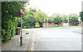
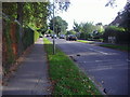
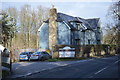
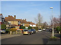
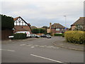
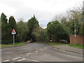
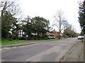
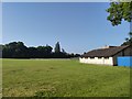
29 photos from this area
Area Information
Key information about the KT4 7LP including its size, population, and administrative classification.
- Area Type
- Postcode
- Area Size
- 1.4 hectares
- Population
- 1529
- Population Density
- 4521 people/km²
House Prices in KT4 7LP
29
Properties
£547,397
Average Sold Price
£213,000
Lowest Price
£1,150,000
Highest Price
Showing 29 properties
| Address | Type | Beds | Baths | Last Sale Price | Last Sale Date | |
|---|---|---|---|---|---|---|
| 41 Leyfield, Worcester Park, KT4 7LP | Detached | 4 | 2 | £1,150,000 | Apr 2022 | |
| 43 Leyfield, Worcester Park, KT4 7LP | Semi-detached | 3 | 1 | £711,000 | May 2019 | |
| 71 Leyfield, Worcester Park, KT4 7LP | Semi-detached | 6 | 1 | £805,000 | Feb 2019 | |
| 75 Leyfield, Worcester Park, KT4 7LP | Semi-detached | 4 | 2 | £775,000 | Nov 2018 | |
| 45 Leyfield, Worcester Park, KT4 7LP | Semi-detached | 3 | 2 | £750,000 | Aug 2018 | |
| 87 Leyfield, Worcester Park, KT4 7LP | Semi-detached | 5 | - | £715,000 | Jan 2017 | |
| 79 Leyfield, Worcester Park, KT4 7LP | Semi-detached | 3 | 1 | £635,000 | Oct 2015 | |
| 67 Leyfield, Worcester Park, KT4 7LP | Semi-detached | 5 | 3 | £420,000 | Mar 2013 | |
| 57 Leyfield, Worcester Park, KT4 7LP | house | 3 | - | £410,000 | Dec 2010 | |
| 97 Leyfield, Worcester Park, KT4 7LP | Semi-detached | - | - | £362,000 | Dec 2005 |
Page 1 of 3
Energy Efficiency in KT4 7LP
Amenities
Schools
| Rank | School | Type | Entry gender | Ages |
|---|
Explore more schools in this area
Go to Schools tabDemographics
Household Size
Family (3-5 people)
most common
Accommodation Type
Houses
most common
Tenure
74
majority
Ethnic Group
White
most common
Religion
N/A
most common
Household Composition
N/A
most common
Age
47
median
Adults (30-64 years)
most common
Household Deprivation
N/A
with no deprivation
NS-SEC
46
in Lower managerial occupations
Explore more demographic insights in this area
Go to Demographics tabPlanning
Planning Constraints
- Flood RiskPremium
- Ramsar Wetland SitesPremium
- Area of Outstanding Natural BeautyPremium
- Protected Nature ReservePremium
- Protected WoodlandPremium