Area Overview for KT3 5RW
Photos of KT3 5RW
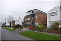
46 photos from this area
Area Information
Key information about the KT3 5RW including its size, population, and administrative classification.
- Area Type
- Postcode
- Area Size
- 2654 m²
- Population
- 1603
- Population Density
- 4251 people/km²
House Prices in KT3 5RW
5
Properties
£426,200
Average Sold Price
£250,000
Lowest Price
£610,000
Highest Price
Showing 5 properties
| Address | Type | Beds | Baths | Last Sale Price | Last Sale Date | |
|---|---|---|---|---|---|---|
| 248 South Lane, New Malden, KT3 5RW | house | 3 | 1 | £600,000 | Mar 2021 | |
| 240 South Lane, New Malden, KT3 5RW | Semi-detached | 4 | 2 | £610,000 | Mar 2021 | |
| 246 South Lane, New Malden, KT3 5RW | Detached | 2 | 1 | £379,000 | Jun 2013 | |
| 244 South Lane, New Malden, KT3 5RW | Detached | - | - | £292,000 | Jan 2006 | |
| 242 South Lane, New Malden, KT3 5RW | Semi-detached | 4 | 1 | £250,000 | Nov 2004 |
Energy Efficiency in KT3 5RW
Amenities
Schools
| Rank | School | Type | Entry gender | Ages |
|---|
Explore more schools in this area
Go to Schools tabDemographics
Household Size
Family (3-5 people)
most common
Accommodation Type
Houses
most common
Tenure
83
majority
Ethnic Group
White
most common
Religion
N/A
most common
Household Composition
N/A
most common
Age
47
median
Adults (30-64 years)
most common
Household Deprivation
N/A
with no deprivation
NS-SEC
42
in Lower managerial occupations
Explore more demographic insights in this area
Go to Demographics tabPlanning
Planning Constraints
- Flood RiskPremium
- Ramsar Wetland SitesPremium
- Area of Outstanding Natural BeautyPremium
- Protected Nature ReservePremium
- Protected WoodlandPremium