Area Overview for KT3 5BA
Photos of KT3 5BA
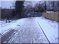
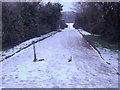
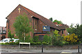
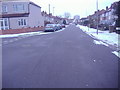
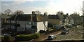
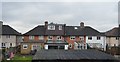
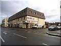
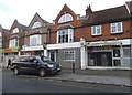
52 photos from this area
Area Information
Key information about the KT3 5BA including its size, population, and administrative classification.
- Area Type
- Postcode
- Area Size
- 3843 m²
- Population
- 1946
- Population Density
- 7622 people/km²
House Prices in KT3 5BA
14
Properties
£437,796
Average Sold Price
£69,750
Lowest Price
£770,000
Highest Price
Showing 14 properties
| Address | Type | Beds | Baths | Last Sale Price | Last Sale Date | |
|---|---|---|---|---|---|---|
| 42 Westbury Road, New Malden, KT3 5BA | Semi-detached | 3 | 1 | £660,000 | Feb 2022 | |
| 25 Westbury Road, New Malden, KT3 5BA | Flat | 1 | - | £624,000 | Aug 2020 | |
| 36 Westbury Road, New Malden, KT3 5BA | Semi-detached | 4 | 2 | £770,000 | Dec 2017 | |
| 40 Westbury Road, New Malden, KT3 5BA | Semi-detached | 4 | 2 | £549,950 | Jul 2012 | |
| 29 Westbury Road, New Malden, KT3 5BA | Semi-detached | 5 | 2 | £535,000 | Sep 2009 | |
| 27 Westbury Road, New Malden, KT3 5BA | Flat | - | - | £237,000 | Aug 2008 | |
| 32 Westbury Road, New Malden, KT3 5BA | Semi-detached | 3 | 1 | £265,000 | Nov 2004 | |
| 44 Westbury Road, New Malden, KT3 5BA | Semi-detached | 4 | 2 | £229,460 | Oct 2001 | |
| 25A Westbury Road, New Malden, KT3 5BA | Flat | - | - | £69,750 | Nov 1996 | |
| 38 Westbury Road, New Malden, KT3 5BA | Semi-detached | 5 | 3 | - | - |
Page 1 of 2
Energy Efficiency in KT3 5BA
Amenities
Schools
| Rank | School | Type | Entry gender | Ages |
|---|
Explore more schools in this area
Go to Schools tabDemographics
Household Size
Family (3-5 people)
most common
Accommodation Type
Houses
most common
Tenure
54
majority
Ethnic Group
White
most common
Religion
N/A
most common
Household Composition
N/A
most common
Age
47
median
Adults (30-64 years)
most common
Household Deprivation
N/A
with no deprivation
NS-SEC
40
in Lower managerial occupations
Explore more demographic insights in this area
Go to Demographics tabPlanning
Planning Constraints
- Flood RiskPremium
- Ramsar Wetland SitesPremium
- Area of Outstanding Natural BeautyPremium
- Protected Nature ReservePremium
- Protected WoodlandPremium