Area Overview for KT3 5AP
Photos of KT3 5AP

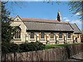
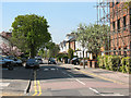
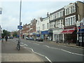
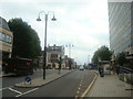
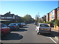
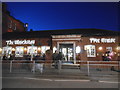
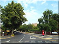
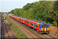


90 photos from this area
Area Information
Key information about the KT3 5AP including its size, population, and administrative classification.
- Area Type
- Postcode
- Area Size
- 1.5 hectares
- Population
- 1946
- Population Density
- 7622 people/km²
House Prices in KT3 5AP
22
Properties
£411,536
Average Sold Price
£45,000
Lowest Price
£1,115,000
Highest Price
Showing 22 properties
| Address | Type | Beds | Baths | Last Sale Price | Last Sale Date | |
|---|---|---|---|---|---|---|
| 34, Sandal Court, Sandal Road, New Malden, KT3 5AP | Flat | 1 | 1 | £312,500 | Feb 2023 | |
| 36, Sandal Court, Sandal Road, New Malden, KT3 5AP | Flat | - | - | £300,000 | Jun 2021 | |
| 14 Sandal Road, New Malden, KT3 5AP | Semi-detached | 4 | 2 | £685,000 | Mar 2021 | |
| 18 Sandal Road, New Malden, KT3 5AP | Semi-detached | 5 | 3 | £1,115,000 | Oct 2019 | |
| 32, Sandal Court, Sandal Road, New Malden, KT3 5AP | Flat | 2 | - | £262,000 | Oct 2013 | |
| 20 Sandal Road, New Malden, KT3 5AP | Detached | 3 | - | £570,000 | Nov 2012 | |
| 28, Sandal Court, Sandal Road, New Malden, KT3 5AP | Flat | 2 | 1 | £245,000 | Jul 2007 | |
| 4 Sandal Road, New Malden, KT3 5AP | Detached | - | - | £440,000 | Jun 2006 | |
| 22 Sandal Road, New Malden, KT3 5AP | Detached | - | - | £460,000 | Nov 2005 | |
| 3 Sandal Road, New Malden, KT3 5AP | Semi-detached | 3 | 2 | £395,000 | Nov 2003 |
Page 1 of 3
Energy Efficiency in KT3 5AP
Amenities
Schools
| Rank | School | Type | Entry gender | Ages |
|---|
Explore more schools in this area
Go to Schools tabDemographics
Household Size
Family (3-5 people)
most common
Accommodation Type
Houses
most common
Tenure
54
majority
Ethnic Group
White
most common
Religion
N/A
most common
Household Composition
N/A
most common
Age
47
median
Adults (30-64 years)
most common
Household Deprivation
N/A
with no deprivation
NS-SEC
40
in Lower managerial occupations
Explore more demographic insights in this area
Go to Demographics tabPlanning
Planning Constraints
- Flood RiskPremium
- Ramsar Wetland SitesPremium
- Area of Outstanding Natural BeautyPremium
- Protected Nature ReservePremium
- Protected WoodlandPremium