Area Overview for KT3 4LS
Photos of KT3 4LS


Area Information
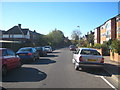
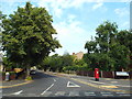
KT3 4LS is a small, tightly knit residential postcode in England, home to 1720 people. It sits in a quiet, compact cluster of properties, offering a mix of convenience and tranquillity. The area’s character is defined by its proximity to transport networks and local amenities, making it accessible yet distinct. With a median age of 47, the community is predominantly composed of adults aged 30–64, suggesting a stable, family-oriented demographic. The area’s small size means residents are likely to know their neighbours, fostering a sense of cohesion. Nearby, retail options like Lidl New and Budgens Kingston provide everyday essentials, while rail and metro stations such as New Malden and Morden offer easy access to London. The postcode’s low flood risk and absence of environmental constraints further enhance its appeal. For those seeking a balance between suburban comfort and urban connectivity, KT3 4LS offers a compact, well-served living environment.
- Area Type
- Postcode
- Area Size
- Not available
- Population
- 1720
- Population Density
- 9994 people/km²
KT3 4LS is a home-ownership-focused area, with 61% of properties owned by residents rather than rented. The housing stock is predominantly houses, which is unusual for smaller postcode areas, suggesting a mix of larger, family-friendly properties. This composition indicates a market skewed towards owner-occupiers, with fewer rental properties available. Given the area’s small size, the housing stock is limited, meaning buyers may need to consider nearby postcode areas for more options. The presence of houses rather than flats or apartments implies a focus on private, spacious living, which could appeal to those prioritising property value retention. However, the compact nature of KT3 4LS means the local market is not expansive, requiring buyers to look beyond immediate surroundings for broader choices.
House Prices in KT3 4LS
No properties found in this postcode.
Energy Efficiency in KT3 4LS
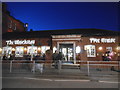
Living in KT3 4LS offers access to a range of amenities within practical reach. Retail options include Lidl New, Budgens Kingston, and M&S New, providing everyday shopping needs. The area’s rail network, with stations like New Malden and Raynes Park, and metro stops such as Morden, facilitate easy travel for work or leisure. For water-based activities, nearby ferry piers like Kingston Turks Pier and Ditton Island Ferry Landing offer scenic routes. While the area lacks large parks or leisure complexes, its proximity to transport links means residents can quickly reach larger recreational spaces. The presence of multiple retail and transport hubs ensures daily life is convenient, with a balance between local services and regional accessibility.
Amenities
Schools
| Rank | School | Type | Entry gender | Ages |
|---|
Explore more schools in this area
Go to Schools tabDemographics
KT3 4LS has a median age of 47, with the majority of residents falling within the 30–64 age range. This suggests a mature, established community with strong family ties. Home ownership rates are 61%, indicating a significant proportion of residents are long-term property owners. The area is predominantly composed of houses, reflecting a preference for detached or semi-detached living. The predominant ethnic group is the Asian community, which contributes to the area’s cultural diversity. While no specific deprivation data is provided, the demographic profile implies a relatively stable population with a focus on settled, middle-aged households. The absence of younger or older age groups may affect the dynamics of local services and amenities.
Household Size
Accommodation Type
Tenure
Ethnic Group
Religion
Household Composition
Age
Household Deprivation
NS-SEC
Explore more demographic insights in this area
Go to Demographics tabPlanning
Planning Constraints
- Flood RiskPremium
- Ramsar Wetland SitesPremium
- Area of Outstanding Natural BeautyPremium
- Protected Nature ReservePremium
- Protected WoodlandPremium