Area Overview for KT3 4HX
Photos of KT3 4HX

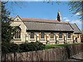
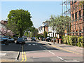
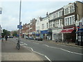
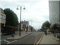
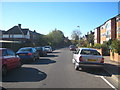

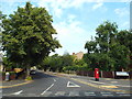


90 photos from this area
Area Information
Key information about the KT3 4HX including its size, population, and administrative classification.
- Area Type
- Postcode
- Area Size
- 6180 m²
- Population
- 2013
- Population Density
- 6568 people/km²
House Prices in KT3 4HX
23
Properties
£340,021
Average Sold Price
£116,000
Lowest Price
£865,000
Highest Price
Showing 23 properties
| Address | Type | Beds | Baths | Last Sale Price | Last Sale Date | |
|---|---|---|---|---|---|---|
| 59 Malden Hill Gardens, New Malden, KT3 4HX | Maisonette | 2 | - | £412,000 | Nov 2021 | |
| 65 Malden Hill Gardens, New Malden, KT3 4HX | Semi-detached | 4 | 1 | £865,000 | Jan 2021 | |
| 30 Malden Hill Gardens, New Malden, KT3 4HX | Maisonette | 1 | 1 | £520,000 | Aug 2013 | |
| 40 Malden Hill Gardens, New Malden, KT3 4HX | house | 3 | - | £375,000 | Jul 2010 | |
| 42 Malden Hill Gardens, New Malden, KT3 4HX | Semi-detached | - | - | £480,000 | Oct 2007 | |
| 59A Malden Hill Gardens, New Malden, KT3 4HX | Flat | 2 | 1 | £249,999 | May 2007 | |
| 63 Malden Hill Gardens, New Malden, KT3 4HX | Semi-detached | - | - | £395,000 | Sep 2005 | |
| 67 Malden Hill Gardens, New Malden, KT3 4HX | Semi-detached | 4 | - | £359,270 | Jun 2005 | |
| 32 Malden Hill Gardens, New Malden, KT3 4HX | Semi-detached | - | - | £173,000 | Aug 1999 | |
| 34 Malden Hill Gardens, New Malden, KT3 4HX | Semi-detached | 4 | 1 | £190,000 | Aug 1999 |
Page 1 of 3
Energy Efficiency in KT3 4HX
Amenities
Schools
| Rank | School | Type | Entry gender | Ages |
|---|
Explore more schools in this area
Go to Schools tabDemographics
Household Size
Family (3-5 people)
most common
Accommodation Type
Houses
most common
Tenure
79
majority
Ethnic Group
White
most common
Religion
N/A
most common
Household Composition
N/A
most common
Age
47
median
Adults (30-64 years)
most common
Household Deprivation
N/A
with no deprivation
NS-SEC
53
in Lower managerial occupations
Explore more demographic insights in this area
Go to Demographics tabPlanning
Planning Constraints
- Flood RiskPremium
- Ramsar Wetland SitesPremium
- Area of Outstanding Natural BeautyPremium
- Protected Nature ReservePremium
- Protected WoodlandPremium