Area Overview for KT3 4AN
Photos of KT3 4AN

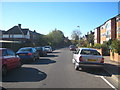
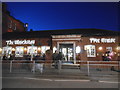
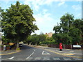
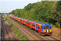


90 photos from this area
Area Information
Key information about the KT3 4AN including its size, population, and administrative classification.
- Area Type
- Postcode
- Area Size
- 1.0 hectares
- Population
- 2013
- Population Density
- 6568 people/km²
House Prices in KT3 4AN
37
Properties
£394,573
Average Sold Price
£84,000
Lowest Price
£819,000
Highest Price
Showing 37 properties
| Address | Type | Beds | Baths | Last Sale Price | Last Sale Date | |
|---|---|---|---|---|---|---|
| 169 Blagdon Road, New Malden, KT3 4AN | Terraced | 3 | 1 | £819,000 | Oct 2025 | |
| 175 Blagdon Road, New Malden, KT3 4AN | Terraced | 3 | 1 | £660,000 | Dec 2023 | |
| 113 Blagdon Road, New Malden, KT3 4AN | Semi-detached | 3 | 1 | £642,000 | Dec 2023 | |
| 133 Blagdon Road, New Malden, KT3 4AN | Terraced | 3 | 1 | £630,000 | Sep 2022 | |
| 117 Blagdon Road, New Malden, KT3 4AN | Semi-detached | 3 | 1 | £675,000 | Aug 2022 | |
| 123 Blagdon Road, New Malden, KT3 4AN | house | 4 | - | £710,000 | Jun 2021 | |
| 181 Blagdon Road, New Malden, KT3 4AN | Terraced | 3 | 1 | £627,100 | Feb 2019 | |
| 111 Blagdon Road, New Malden, KT3 4AN | Semi-detached | 3 | 1 | £650,000 | Dec 2018 | |
| 167 Blagdon Road, New Malden, KT3 4AN | Terraced | 3 | 2 | £460,000 | Jul 2018 | |
| 143 Blagdon Road, New Malden, KT3 4AN | house | 4 | 2 | £625,000 | Sep 2017 |
Page 1 of 4
Energy Efficiency in KT3 4AN
Amenities
Schools
| Rank | School | Type | Entry gender | Ages |
|---|
Explore more schools in this area
Go to Schools tabDemographics
Household Size
Family (3-5 people)
most common
Accommodation Type
Houses
most common
Tenure
79
majority
Ethnic Group
White
most common
Religion
N/A
most common
Household Composition
N/A
most common
Age
47
median
Adults (30-64 years)
most common
Household Deprivation
N/A
with no deprivation
NS-SEC
53
in Lower managerial occupations
Explore more demographic insights in this area
Go to Demographics tabPlanning
Planning Constraints
- Flood RiskPremium
- Ramsar Wetland SitesPremium
- Area of Outstanding Natural BeautyPremium
- Protected Nature ReservePremium
- Protected WoodlandPremium