Area Overview for KT2 7XA
Photos of KT2 7XA
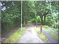
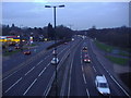

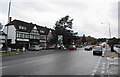
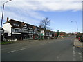
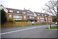
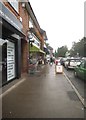

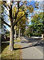
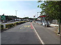
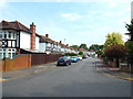
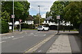
60 photos from this area
Area Information
Key information about the KT2 7XA including its size, population, and administrative classification.
- Area Type
- Postcode
- Area Size
- 2.6 hectares
- Population
- 1333
- Population Density
- 1140 people/km²
House Prices in KT2 7XA
22
Properties
£933,591
Average Sold Price
£650,000
Lowest Price
£1,550,000
Highest Price
Showing 22 properties
| Address | Type | Beds | Baths | Last Sale Price | Last Sale Date | |
|---|---|---|---|---|---|---|
| 19 Wonford Close, Kingston Upon Thames, KT2 7XA | Detached | 5 | 4 | £1,550,000 | Oct 2021 | |
| 8 Wonford Close, Kingston Upon Thames, KT2 7XA | house | - | - | £880,000 | Oct 2019 | |
| 22 Wonford Close, Kingston Upon Thames, KT2 7XA | Semi-detached | 2 | 1 | £760,000 | Sep 2018 | |
| 14 Wonford Close, Kingston Upon Thames, KT2 7XA | house | - | - | £1,040,000 | Jun 2013 | |
| 5 Wonford Close, Kingston Upon Thames, KT2 7XA | Detached | 4 | - | £990,000 | Jan 2012 | |
| 2 Wonford Close, Kingston Upon Thames, KT2 7XA | Detached | 4 | 2 | £992,000 | Oct 2011 | |
| 9 Wonford Close, Kingston Upon Thames, KT2 7XA | house | - | - | £990,000 | Jul 2011 | |
| 17 Wonford Close, Kingston Upon Thames, KT2 7XA | house | - | - | £815,005 | Mar 2007 | |
| 12 Wonford Close, Kingston Upon Thames, KT2 7XA | Detached | - | - | £760,000 | Aug 2006 | |
| 10 Wonford Close, Kingston Upon Thames, KT2 7XA | Detached | - | - | £842,500 | Apr 2006 |
Page 1 of 3
Energy Efficiency in KT2 7XA
Amenities
Schools
| Rank | School | Type | Entry gender | Ages |
|---|
Explore more schools in this area
Go to Schools tabDemographics
Household Size
Family (3-5 people)
most common
Accommodation Type
Houses
most common
Tenure
75
majority
Ethnic Group
White
most common
Religion
N/A
most common
Household Composition
N/A
most common
Age
47
median
Adults (30-64 years)
most common
Household Deprivation
N/A
with no deprivation
NS-SEC
50
in Lower managerial occupations
Explore more demographic insights in this area
Go to Demographics tabPlanning
Planning Constraints
- Flood RiskPremium
- Ramsar Wetland SitesPremium
- Area of Outstanding Natural BeautyPremium
- Protected Nature ReservePremium
- Protected WoodlandPremium