Area Overview for KT2 6QU
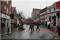
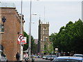
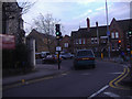
Photos of KT2 6QU


Area Information
KT2 6QU is a small, tightly knit residential postcode in England with a population of 2513. It is a compact area where daily life is shaped by its proximity to Kingston’s amenities and transport links. The community here is predominantly composed of adults aged 30–64, reflecting a mature demographic with a median age of 47. This area is characterised by a mix of flats, which dominate the housing stock, and a relatively low home ownership rate of 35%. While the area lacks large-scale developments, its proximity to Kingston’s cultural and commercial hubs offers residents access to a range of services. The postcode’s small size means it is well-served by nearby schools, transport networks, and retail options, making it a practical choice for those seeking a balance between convenience and a quieter residential environment. The absence of major planning constraints, such as protected woodlands or AONB areas, ensures development is not restricted, though the area’s charm lies in its modest scale and local character.
- Area Type
- Postcode
- Area Size
- Not available
- Population
- 2513
- Population Density
- 8006 people/km²
KT2 6QU’s property market is defined by its low home ownership rate of 35% and a housing stock that is predominantly flats. This suggests the area is more of a rental market than an owner-occupied one, with limited availability of larger or detached properties. The concentration of flats may appeal to buyers seeking compact, low-maintenance homes, but it also means the market is not diverse in terms of property types. Given the postcode’s small size, the immediate surroundings offer few alternatives for buyers seeking different housing styles. The low home ownership rate could indicate a reliance on private landlords or local housing associations, which may influence rental prices and availability. For buyers, this means competition for flats may be higher, and opportunities for purchasing larger properties are scarce. The area’s practical size and proximity to Kingston’s amenities make it a niche market for those prioritising convenience over property variety.
House Prices in KT2 6QU
No properties found in this postcode.
Energy Efficiency in KT2 6QU
Residents of KT2 6QU enjoy a range of amenities within walking or short driving distance. Retail options include Aldi Kingston, Tesco Kingston, and Sainsburys Kingston, providing everyday shopping convenience. The area’s proximity to multiple rail stations, such as Kingston Station and Berrylands, along with ferry services like Kingston Town End Pier, enhances mobility for both leisure and commuting. While specific parks or leisure facilities are not listed, the presence of ferry access and rail links suggests opportunities for outdoor activities near waterways or nearby green spaces. The combination of retail, transport, and water-based access contributes to a lifestyle that balances practicality with local charm. This accessibility ensures daily tasks are efficient, while the area’s compact size fosters a sense of community.
Amenities
Schools
Residents of KT2 6QU have access to a range of educational institutions, including Fairfield Nursery School, which provides early years education. For primary schooling, King Athelstan Primary School and St John’s C of E Primary School both hold Ofsted ratings of ‘good’, offering families reliable options for foundational education. Kingston Grammar School, an independent institution, caters to secondary education, providing a contrast to the state-run primary schools. The mix of nursery, state primary, and independent secondary schooling reflects a diversity of choices, allowing families to select between public and private education. The presence of two ‘good’-rated primary schools suggests a strong local education infrastructure, though the absence of secondary state schools may require students to commute for higher education. This combination of school types ensures flexibility for families with differing educational preferences.
| Rank | School | Type | Entry gender | Ages |
|---|
Explore more schools in this area
Go to Schools tabDemographics
The population of KT2 6QU is 2513, with a median age of 47, indicating a community skewed towards middle-aged and older residents. The most common age range is adults aged 30–64, suggesting a stable, established population. Home ownership here is relatively low at 35%, which implies a rental market dominates. The accommodation type is predominantly flats, reflecting a housing stock suited to smaller households or those prioritising convenience over larger properties. The predominant ethnic group is White, though specific data on diversity is not provided. The area’s demographic profile suggests a community with limited generational turnover, where families and long-term residents form the core. The 35% home ownership rate may indicate economic or social factors influencing property tenure, but it also means the area is not heavily reliant on owner-occupied homes. This dynamic could affect the local property market’s responsiveness to buyer demand.
Household Size
Accommodation Type
Tenure
Ethnic Group
Religion
Household Composition
Age
Household Deprivation
NS-SEC
Explore more demographic insights in this area
Go to Demographics tabPlanning
Planning Constraints
- Flood RiskPremium
- Ramsar Wetland SitesPremium
- Area of Outstanding Natural BeautyPremium
- Protected Nature ReservePremium
- Protected WoodlandPremium