Area Overview for KT2 5NT
Photos of KT2 5NT

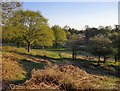

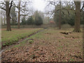
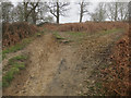
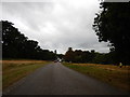

78 photos from this area
Area Information
Key information about the KT2 5NT including its size, population, and administrative classification.
- Area Type
- Postcode
- Area Size
- 8901 m²
- Population
- Not available
- Population Density
- Not available
House Prices in KT2 5NT
20
Properties
£449,923
Average Sold Price
£232,000
Lowest Price
£909,000
Highest Price
Showing 20 properties
| Address | Type | Beds | Baths | Last Sale Price | Last Sale Date | |
|---|---|---|---|---|---|---|
| 177 Tudor Drive, Kingston Upon Thames, KT2 5NT | Semi-detached | 4 | 2 | £909,000 | Oct 2024 | |
| 165 Tudor Drive, Kingston Upon Thames, KT2 5NT | Semi-detached | 3 | 1 | £865,000 | Dec 2023 | |
| 173 Tudor Drive, Kingston Upon Thames, KT2 5NT | Semi-detached | 3 | 1 | £690,000 | May 2019 | |
| 167 Tudor Drive, Kingston Upon Thames, KT2 5NT | house | - | - | £795,000 | Dec 2016 | |
| 153 Tudor Drive, Kingston Upon Thames, KT2 5NT | Semi-detached | 4 | - | £539,950 | Feb 2013 | |
| 149 Tudor Drive, Kingston Upon Thames, KT2 5NT | house | - | - | £427,500 | Nov 2012 | |
| 175 Tudor Drive, Kingston Upon Thames, KT2 5NT | Semi-detached | - | - | £441,000 | Dec 2007 | |
| 163 Tudor Drive, Kingston Upon Thames, KT2 5NT | house | - | - | £241,950 | Dec 2006 | |
| 151 Tudor Drive, Kingston Upon Thames, KT2 5NT | Terraced | - | - | £310,000 | Jul 2006 | |
| 147 Tudor Drive, Kingston Upon Thames, KT2 5NT | Terraced | - | - | £282,500 | Nov 2005 |
Page 1 of 2
Energy Efficiency in KT2 5NT
Amenities
Schools
| Rank | School | Type | Entry gender | Ages |
|---|
Explore more schools in this area
Go to Schools tabDemographics
Household Size
Family (3-5 people)
most common
Accommodation Type
Houses
most common
Tenure
83
majority
Ethnic Group
White
most common
Religion
N/A
most common
Household Composition
N/A
most common
Age
47
median
Adults (30-64 years)
most common
Household Deprivation
N/A
with no deprivation
NS-SEC
51
in Lower managerial occupations
Explore more demographic insights in this area
Go to Demographics tabPlanning
Planning Constraints
- Flood RiskPremium
- Ramsar Wetland SitesPremium
- Area of Outstanding Natural BeautyPremium
- Protected Nature ReservePremium
- Protected WoodlandPremium