Area Overview for KT1 4HA
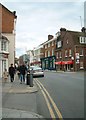
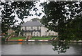
Photos of KT1 4HA


Area Information
KT1 4HA is a small, compact postcode area in England, home to around 1600 residents living at a density of 1477 people per square kilometre. This residential cluster is characterised by its mix of flats, reflecting a community that prioritises compact living. The area’s demographic profile suggests a mature population, with a median age of 47 and the majority of residents falling within the 30-64 age range. This suggests a stable, family-oriented environment where many residents are likely to be established in their careers or retired. The proximity to Kingston, Hampton Wick, and Teddington means residents have access to urban amenities without the congestion of larger cities. Daily life here balances residential tranquillity with practical connectivity, with nearby schools, transport hubs, and retail options within easy reach. The area’s small size means it is ideal for those seeking a close-knit community with a clear sense of place, while still being within commuting distance of London’s broader infrastructure.
- Area Type
- Postcode
- Area Size
- Not available
- Population
- 1600
- Population Density
- 1477 people/km²
The property market in KT1 4HA is defined by its high proportion of flats, with 52% of homes owner-occupied and 48% rented. This suggests a balance between long-term residents and tenants, though the small size of the area means the housing stock is limited. The prevalence of flats indicates a focus on space-efficient living, which may appeal to commuters or those prioritising affordability over larger properties. Buyers should note that the area is not a traditional suburban market but a compact residential cluster, meaning property availability is constrained. For those seeking owner-occupied homes, the mix of flats may present opportunities, but the small footprint of the postcode means competition for listings could be fierce. Investors might find rental potential in the 48% of properties that are let, though the area’s proximity to transport links could enhance demand.
House Prices in KT1 4HA
No properties found in this postcode.
Energy Efficiency in KT1 4HA
Residents of KT1 4HA enjoy a range of amenities within practical reach, enhancing daily life. Retail options include major chains like Waitrose, M&S, and Sainsburys, providing convenience for shopping. The area’s proximity to ferry piers, such as Kingston Turks Pier, adds a unique dimension to local transport and leisure. Metro stops like Dundonald Road Tram Stop connect to broader transport networks, facilitating travel to nearby towns. While the data does not specify parks or leisure facilities, the presence of multiple retail and transport hubs suggests a focus on practicality over expansive recreational spaces. The compact nature of the area means amenities are closely clustered, reducing the need for long commutes. This layout is ideal for those prioritising accessibility over large-scale leisure options, though it may not suit those seeking extensive green spaces or cultural venues.
Amenities
Schools
Residents of KT1 4HA have access to two primary schools within practical reach. Hampton Wick Infant and Nursery School holds an Ofsted rating of outstanding, offering high-quality early education for younger children. St John the Baptist Church of England Junior School, also nearby, has a good Ofsted rating, providing a solid foundation for primary education. The presence of two primary schools suggests a focus on family-friendly infrastructure, though no secondary schools are listed in the data. For parents, the combination of an outstanding and a good-rated school offers reassurance about educational standards. However, families requiring secondary education may need to look further afield, potentially increasing commuting times. The schools’ proximity to the area makes KT1 4HA attractive for households with young children, though the absence of secondary options is a consideration for long-term planning.
| Rank | School | Type | Entry gender | Ages |
|---|
Explore more schools in this area
Go to Schools tabDemographics
The population of KT1 4HA is predominantly adults aged 30-64, with a median age of 47. This indicates a community of middle-aged individuals, many of whom may be in their peak earning years or approaching retirement. Home ownership rates stand at 52%, meaning nearly half of residents rent their homes. The accommodation type is almost entirely flats, suggesting a focus on high-density living. The predominant ethnic group is White, though specific data on diversity is not provided. The age profile and ownership figures imply a stable, long-term resident base, with fewer young families or students. The absence of detailed deprivation data means it is unclear whether the area faces economic challenges, but the low crime score of 71/100 suggests a generally secure environment. This demographic mix may appeal to professionals seeking affordable housing near urban centres, though the lack of younger residents could affect local services and amenities.
Household Size
Accommodation Type
Tenure
Ethnic Group
Religion
Household Composition
Age
Household Deprivation
NS-SEC
Explore more demographic insights in this area
Go to Demographics tabPlanning
Planning Constraints
- Flood RiskPremium
- Ramsar Wetland SitesPremium
- Area of Outstanding Natural BeautyPremium
- Protected Nature ReservePremium
- Protected WoodlandPremium