Area Overview for KT1 4DN
Photos of KT1 4DN


Area Information
KT1 4DN is a small, tightly knit residential cluster in England, home to 2,282 people. The area’s compact nature means it offers a quiet, community-focused lifestyle, with easy access to nearby towns and transport links. Residents here are predominantly adults aged 30–64, reflecting a mature demographic that likely values stability and convenience. Daily life is shaped by the proximity to retail, transport, and leisure options, which are all within practical reach. The area’s character is defined by its blend of residential simplicity and connectivity, making it appealing to those seeking a balance between urban accessibility and a calmer, more manageable environment. While the postcode covers a limited physical space, it is well-served by nearby amenities, from supermarkets to rail stations, ensuring that residents have little need to travel far for essentials. This makes KT1 4DN a practical choice for those prioritising ease of access without sacrificing a sense of local identity.
- Area Type
- Postcode
- Area Size
- Not available
- Population
- 2282
- Population Density
- 9943 people/km²
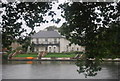
The property market in KT1 4DN is characterised by a high proportion of flats, with 54% of homes being owner-occupied. This suggests a mix of long-term residents and possibly some rental properties, though the exact balance between owner-occupied and rental units is not specified. The small size of the area means the housing stock is limited, which could make it a competitive market for buyers. Flats in this area are likely to be part of larger residential developments, given the compact nature of the postcode. For buyers, this implies that available properties may be fewer in number and potentially more sought after, particularly given the area’s proximity to transport and amenities. The focus on flats also indicates a preference for low-maintenance living, which could appeal to those prioritising convenience over larger homes.
House Prices in KT1 4DN
No properties found in this postcode.
Energy Efficiency in KT1 4DN
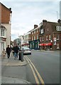
Living in KT1 4DN offers access to a range of amenities that support both daily needs and leisure. Retail options include Co-op Teddington, Sainsburys Sury, and Waitrose Kingston, ensuring residents have nearby supermarkets for groceries and essentials. The area’s transport links also open up broader opportunities, with rail stations providing access to larger towns and cities. While the immediate vicinity may not have extensive parks or leisure facilities, the proximity to Kingston and Teddington likely means residents can enjoy cultural and recreational offerings in these nearby towns. The combination of practical retail access and transport connectivity creates a lifestyle that prioritises convenience, allowing residents to manage errands and travel efficiently without long commutes.
Amenities
Schools
| Rank | School | Type | Entry gender | Ages |
|---|
Explore more schools in this area
Go to Schools tabDemographics
The community in KT1 4DN is predominantly composed of adults aged 30–64, with a median age of 47. This suggests a population that is largely established, with many likely in their peak working years. Home ownership sits at 54%, indicating a mix of owner-occupied properties and rental units. The accommodation type is primarily flats, which may reflect the area’s compact layout and possibly its history as a purpose-built residential cluster. The predominant ethnic group is White, though the data does not provide further breakdowns of diversity. With no specific deprivation statistics available, the area’s quality of life appears to be supported by its infrastructure and amenities. The demographic profile suggests a community that is stable, with a focus on practical living over transient or high-turnover housing.
Household Size
Accommodation Type
Tenure
Ethnic Group
Religion
Household Composition
Age
Household Deprivation
NS-SEC
Explore more demographic insights in this area
Go to Demographics tabPlanning
Planning Constraints
- Flood RiskPremium
- Ramsar Wetland SitesPremium
- Area of Outstanding Natural BeautyPremium
- Protected Nature ReservePremium
- Protected WoodlandPremium
- Crime RiskPremium