Area Overview for KT1 4DG
Photos of KT1 4DG
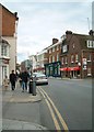
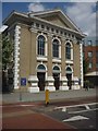
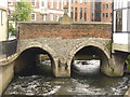

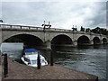
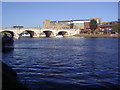
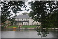
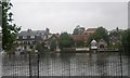
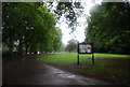
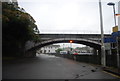
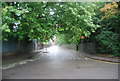
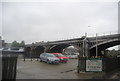
100 photos from this area
Area Information
Key information about the KT1 4DG including its size, population, and administrative classification.
- Area Type
- Postcode
- Area Size
- 7668 m²
- Population
- 1600
- Population Density
- 1477 people/km²
House Prices in KT1 4DG
65
Properties
£531,567
Average Sold Price
£212,000
Lowest Price
£985,000
Highest Price
Showing 65 properties
| Address | Type | Beds | Baths | Last Sale Price | Last Sale Date | |
|---|---|---|---|---|---|---|
| Hope Cottage, 69 High Street, Hampton Wick, KT1 4DG | Terraced | 3 | 2 | £780,000 | Jul 2025 | |
| 95 High Street, Hampton Wick, KT1 4DG | Semi-detached | 2 | 1 | £552,000 | Oct 2024 | |
| 75 High Street, Hampton Wick, KT1 4DG | Terraced | 2 | 1 | £442,500 | Nov 2023 | |
| 51 High Street, Hampton Wick, KT1 4DG | Terraced | 3 | 1 | £985,000 | Apr 2023 | |
| 93 High Street, Hampton Wick, KT1 4DG | Flat | 2 | 1 | £230,000 | Jan 2023 | |
| 49 High Street, Hampton Wick, KT1 4DG | house | - | - | £850,000 | May 2022 | |
| 71 High Street, Hampton Wick, KT1 4DG | Terraced | 3 | 1 | £465,000 | Jun 2021 | |
| 89 High Street, Hampton Wick, KT1 4DG | house | - | - | £780,000 | Mar 2021 | |
| 87 High Street, Hampton Wick, KT1 4DG | Semi-detached | 4 | 1 | £667,500 | Apr 2019 | |
| 67 High Street, Hampton Wick, KT1 4DG | Terraced | 2 | 1 | £475,000 | Oct 2017 |
Page 1 of 7
Energy Efficiency in KT1 4DG
Amenities
Schools
| Rank | School | Type | Entry gender | Ages |
|---|
Explore more schools in this area
Go to Schools tabDemographics
Household Size
Two person
most common
Accommodation Type
Flats
most common
Tenure
52
majority
Ethnic Group
White
most common
Religion
N/A
most common
Household Composition
N/A
most common
Age
47
median
Adults (30-64 years)
most common
Household Deprivation
N/A
with no deprivation
NS-SEC
57
in Lower managerial occupations
Explore more demographic insights in this area
Go to Demographics tabPlanning
Planning Constraints
- Flood RiskPremium
- Ramsar Wetland SitesPremium
- Area of Outstanding Natural BeautyPremium
- Protected Nature ReservePremium
- Protected WoodlandPremium