Area Overview for KT1 4BT
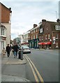
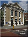
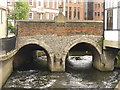
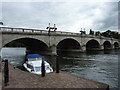
Photos of KT1 4BT


Area Information
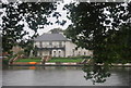
KT1 4BT is a compact residential postcode in England, home to 1600 people spread across a densely populated area with 1477 residents per square kilometre. This small cluster of homes sits in a well-established part of the country, where daily life is shaped by proximity to local amenities and transport links. The area’s character is defined by its mix of practical living spaces and accessible services, making it suitable for those seeking a balanced lifestyle. With a median age of 47, the community is predominantly composed of adults aged 30-64, suggesting a mature, settled population. The presence of nearby primary schools, retail hubs, and transport options means residents can easily access essentials without needing to travel far. While the area is small, its connectivity to Kingston, Hampton Wick, and surrounding towns ensures it is not isolated. KT1 4BT offers a blend of residential comfort and functional infrastructure, ideal for those prioritising convenience without compromising on quality of life.
- Area Type
- Postcode
- Area Size
- Not available
- Population
- 1600
- Population Density
- 1477 people/km²
KT1 4BT is characterised by a housing stock that is 52% owner-occupied, with the remaining properties likely in the rental market. The predominant accommodation type is flats, which suggests a focus on medium-density living rather than detached homes. This configuration is typical of areas with limited space, where developers have prioritised efficient use of land. For buyers, this means the market is more aligned with rental demand than outright purchase, though owner-occupiers still form a significant portion of the population. The small size of the postcode area implies that properties are closely grouped, potentially offering a tight-knit community feel. However, the availability of flats may also mean fewer options for larger families or those seeking more private outdoor space. Buyers should consider the proximity to transport and amenities when evaluating properties in this area, as these factors are key to the region’s appeal.
House Prices in KT1 4BT
No properties found in this postcode.
Energy Efficiency in KT1 4BT
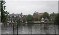
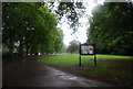
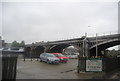
Living in KT1 4BT offers access to a range of amenities within walking or short driving distance. The area is near Kingston’s major retail outlets, including Waitrose, M&S, and Sainsburys, providing everyday shopping needs. For leisure, residents can use nearby ferry services at Kingston Turks Pier, Hampton Court Pier, and Kingston Town End Pier, offering scenic routes along the Thames. Public transport options are plentiful, with rail stations at Hampton Wick and Kingston, as well as metro stops like Dundonald Road and Merton Park. The presence of these services ensures residents can easily reach parks, restaurants, and other attractions in surrounding areas. The combination of retail, transport, and waterfront access contributes to a lifestyle that balances convenience with recreational opportunities, making KT1 4BT a practical choice for those seeking a well-connected community.
Amenities
Schools
Residents of KT1 4BT have access to two primary schools within practical reach. Hampton Wick Infant and Nursery School is rated outstanding by Ofsted, offering a high standard of early education. Nearby, St John the Baptist Church of England Junior School holds a good rating, providing a solid foundation for primary education. The presence of both state and church-affiliated schools gives families options depending on their preferences. These institutions are likely to serve the local community, including children from the area’s 30-64 age demographic. With a population of 1600, the schools may have moderate class sizes, ensuring individual attention for students. The proximity of these schools to residential properties makes KT1 4BT an attractive choice for families prioritising quality education without long commutes.
| Rank | School | Type | Entry gender | Ages |
|---|---|---|---|---|
| 1 | Hampton Wick Infant and Nursery School | primary | N/A | N/A |
| 2 | St John the Baptist Church of England Junior School | primary | N/A | N/A |
Explore more schools in this area
Go to Schools tabDemographics
KT1 4BT has a median age of 47, with the majority of residents falling within the 30-64 age range. This indicates a community of established adults, likely with families or long-term careers. Home ownership rates stand at 52%, meaning nearly half of properties are owner-occupied, while the remaining 48% are likely rental properties. The predominant accommodation type is flats, suggesting a mix of older housing stock and purpose-built residential units. The area’s population is predominantly White, though specific data on other ethnic groups is not provided. With a population density of 1477 people per square kilometre, the area is relatively compact, which may influence the social dynamics and availability of shared spaces. The low crime risk score of 71/100 further supports the area’s appeal as a safe, stable environment for families and individuals alike.
Household Size
Accommodation Type
Tenure
Ethnic Group
Religion
Household Composition
Age
Household Deprivation
NS-SEC
Explore more demographic insights in this area
Go to Demographics tabPlanning
Planning Constraints
- Flood RiskPremium
- Ramsar Wetland SitesPremium
- Area of Outstanding Natural BeautyPremium
- Protected Nature ReservePremium
- Protected WoodlandPremium
- Crime RiskPremium