Area Overview for KT1 3HJ
Photos of KT1 3HJ
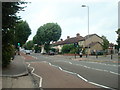
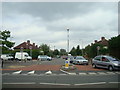
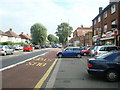
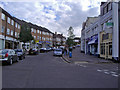
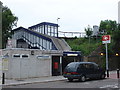
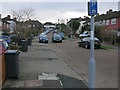
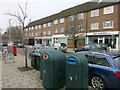

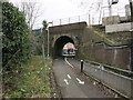


76 photos from this area
Area Information
Key information about the KT1 3HJ including its size, population, and administrative classification.
- Area Type
- Postcode
- Area Size
- 6594 m²
- Population
- 1892
- Population Density
- 27460 people/km²
House Prices in KT1 3HJ
40
Properties
£289,779
Average Sold Price
£59,000
Lowest Price
£521,000
Highest Price
Showing 40 properties
| Address | Type | Beds | Baths | Last Sale Price | Last Sale Date | |
|---|---|---|---|---|---|---|
| 20 Vincent Road, Kingston Upon Thames, KT1 3HJ | Semi-detached | 2 | 1 | £521,000 | Feb 2025 | |
| 8 Vincent Road, Kingston Upon Thames, KT1 3HJ | Semi-detached | 2 | 1 | £515,000 | Oct 2024 | |
| 60 Vincent Road, Kingston Upon Thames, KT1 3HJ | Terraced | 2 | 1 | £340,000 | Mar 2024 | |
| 12 Vincent Road, Kingston Upon Thames, KT1 3HJ | Semi-detached | 2 | 1 | £505,000 | Sep 2022 | |
| 46 Vincent Road, Kingston Upon Thames, KT1 3HJ | Terraced | 2 | 1 | £436,000 | May 2022 | |
| 66 Vincent Road, Kingston Upon Thames, KT1 3HJ | Terraced | 2 | 1 | £397,000 | Nov 2021 | |
| 24 Vincent Road, Kingston Upon Thames, KT1 3HJ | house | 2 | 1 | £400,000 | Feb 2020 | |
| 30 Vincent Road, Kingston Upon Thames, KT1 3HJ | Semi-detached | 2 | 1 | £417,000 | Jan 2020 | |
| 42 Vincent Road, Kingston Upon Thames, KT1 3HJ | Terraced | 2 | 1 | £401,500 | Jan 2018 | |
| 32 Vincent Road, Kingston Upon Thames, KT1 3HJ | Semi-detached | 3 | 1 | £350,000 | Mar 2016 |
Page 1 of 4
Energy Efficiency in KT1 3HJ
Amenities
Schools
| Rank | School | Type | Entry gender | Ages |
|---|
Explore more schools in this area
Go to Schools tabDemographics
Household Size
Family (3-5 people)
most common
Accommodation Type
Flats
most common
Tenure
14
majority
Ethnic Group
White
most common
Religion
N/A
most common
Household Composition
N/A
most common
Age
22
median
Adults (30-64 years)
most common
Household Deprivation
N/A
with no deprivation
NS-SEC
16
in Lower managerial occupations
Explore more demographic insights in this area
Go to Demographics tabPlanning
Planning Constraints
- Flood RiskPremium
- Ramsar Wetland SitesPremium
- Area of Outstanding Natural BeautyPremium
- Protected Nature ReservePremium
- Protected WoodlandPremium