Area Overview for KT1 3DY
Photos of KT1 3DY
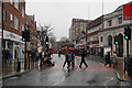


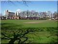

100 photos from this area
Area Information
Key information about the KT1 3DY including its size, population, and administrative classification.
- Area Type
- Postcode
- Area Size
- 9420 m²
- Population
- 2050
- Population Density
- 12246 people/km²
House Prices in KT1 3DY
50
Properties
£428,206
Average Sold Price
£103,000
Lowest Price
£799,950
Highest Price
Showing 50 properties
| Address | Type | Beds | Baths | Last Sale Price | Last Sale Date | |
|---|---|---|---|---|---|---|
| 33 Portman Road, Kingston Upon Thames, KT1 3DY | Detached | 3 | 2 | £750,000 | Oct 2025 | |
| 5 Portman Road, Kingston Upon Thames, KT1 3DY | Semi-detached | 4 | 3 | £785,000 | Jul 2024 | |
| 15 Portman Road, Kingston Upon Thames, KT1 3DY | Semi-detached | 3 | 2 | £680,000 | Apr 2024 | |
| 30 Portman Road, Kingston Upon Thames, KT1 3DY | Semi-detached | 3 | 2 | £742,000 | Mar 2024 | |
| 26 Portman Road, Kingston Upon Thames, KT1 3DY | Semi-detached | 3 | 2 | £799,950 | Nov 2022 | |
| 18 Portman Road, Kingston Upon Thames, KT1 3DY | Retail | 2 | 1 | £572,500 | Aug 2022 | |
| 22 Portman Road, Kingston Upon Thames, KT1 3DY | Semi-detached | 2 | 1 | £725,000 | Dec 2021 | |
| 25 Portman Road, Kingston Upon Thames, KT1 3DY | Semi-detached | 3 | 2 | £492,500 | Feb 2019 | |
| 7 Portman Road, Kingston Upon Thames, KT1 3DY | house | 2 | 1 | £525,000 | Sep 2018 | |
| 1 Portman Road, Kingston Upon Thames, KT1 3DY | Semi-detached | 3 | 1 | £495,000 | Aug 2018 |
Page 1 of 5
Energy Efficiency in KT1 3DY
Amenities
Schools
| Rank | School | Type | Entry gender | Ages |
|---|
Explore more schools in this area
Go to Schools tabDemographics
Household Size
One person
most common
Accommodation Type
Flats
most common
Tenure
41
majority
Ethnic Group
White
most common
Religion
N/A
most common
Household Composition
N/A
most common
Age
47
median
Adults (30-64 years)
most common
Household Deprivation
N/A
with no deprivation
NS-SEC
43
in Lower managerial occupations
Explore more demographic insights in this area
Go to Demographics tabPlanning
Planning Constraints
- Flood RiskPremium
- Ramsar Wetland SitesPremium
- Area of Outstanding Natural BeautyPremium
- Protected Nature ReservePremium
- Protected WoodlandPremium