Area Overview for KT1 2JG
Photos of KT1 2JG


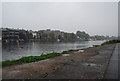
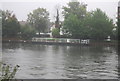
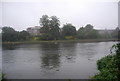
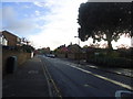

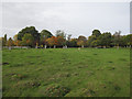


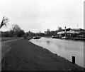
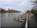
100 photos from this area
Area Information
Key information about the KT1 2JG including its size, population, and administrative classification.
- Area Type
- Postcode
- Area Size
- 8025 m²
- Population
- 2521
- Population Density
- 7230 people/km²
House Prices in KT1 2JG
19
Properties
£727,000
Average Sold Price
£208,000
Lowest Price
£1,295,000
Highest Price
Showing 19 properties
| Address | Type | Beds | Baths | Last Sale Price | Last Sale Date | |
|---|---|---|---|---|---|---|
| 13 Riverside Close, Kingston Upon Thames, KT1 2JG | Semi-detached | 3 | 1 | £1,080,000 | Oct 2024 | |
| 29 Riverside Close, Kingston Upon Thames, KT1 2JG | Semi-detached | 5 | 2 | £970,000 | Mar 2020 | |
| 11 Riverside Close, Kingston Upon Thames, KT1 2JG | Detached | 5 | - | £1,295,000 | Jun 2014 | |
| 15 Riverside Close, Kingston Upon Thames, KT1 2JG | house | 5 | 2 | £750,000 | Nov 2012 | |
| 27 Riverside Close, Kingston Upon Thames, KT1 2JG | house | 4 | - | £615,000 | May 2012 | |
| 33 Riverside Close, Kingston Upon Thames, KT1 2JG | house | - | - | £875,000 | Aug 2008 | |
| 37 Riverside Close, Kingston Upon Thames, KT1 2JG | Semi-detached | - | - | £425,000 | Sep 2004 | |
| 9 Riverside Close, Kingston Upon Thames, KT1 2JG | Detached | 5 | 3 | £325,000 | Jan 2001 | |
| 5 Riverside Close, Kingston Upon Thames, KT1 2JG | Semi-detached | - | - | £208,000 | Aug 1998 | |
| 31 Riverside Close, Kingston Upon Thames, KT1 2JG | Semi-detached | 5 | 2 | - | - |
Page 1 of 2
Energy Efficiency in KT1 2JG
Amenities
Schools
| Rank | School | Type | Entry gender | Ages |
|---|
Explore more schools in this area
Go to Schools tabDemographics
Household Size
One person
most common
Accommodation Type
Flats
most common
Tenure
40
majority
Ethnic Group
White
most common
Religion
N/A
most common
Household Composition
N/A
most common
Age
47
median
Adults (30-64 years)
most common
Household Deprivation
N/A
with no deprivation
NS-SEC
40
in Lower managerial occupations
Explore more demographic insights in this area
Go to Demographics tabPlanning
Planning Constraints
- Flood RiskPremium
- Ramsar Wetland SitesPremium
- Area of Outstanding Natural BeautyPremium
- Protected Nature ReservePremium
- Protected WoodlandPremium