Area Overview for KT1 2EG
Photos of KT1 2EG

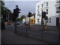
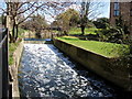

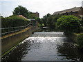
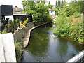
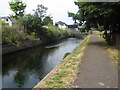
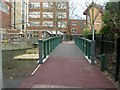

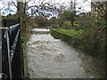
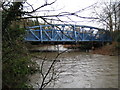
100 photos from this area
Area Information
Key information about the KT1 2EG including its size, population, and administrative classification.
- Area Type
- Postcode
- Area Size
- 7391 m²
- Population
- 2521
- Population Density
- 7230 people/km²
House Prices in KT1 2EG
48
Properties
£214,019
Average Sold Price
£100
Lowest Price
£392,500
Highest Price
Showing 48 properties
| Address | Type | Beds | Baths | Last Sale Price | Last Sale Date | |
|---|---|---|---|---|---|---|
| 43 Penrhyn Gardens, Kingston Upon Thames, KT1 2EG | Flat | 3 | 1 | £392,500 | Jan 2023 | |
| 36 Penrhyn Gardens, Kingston Upon Thames, KT1 2EG | Maisonette | 3 | 1 | £375,000 | Dec 2022 | |
| 59 Penrhyn Gardens, Kingston Upon Thames, KT1 2EG | Flat | - | - | £275,000 | Jun 2021 | |
| 42 Penrhyn Gardens, Kingston Upon Thames, KT1 2EG | Maisonette | - | - | £355,000 | Sep 2020 | |
| 30 Penrhyn Gardens, Kingston Upon Thames, KT1 2EG | Maisonette | - | - | £305,000 | Nov 2019 | |
| 46 Penrhyn Gardens, Kingston Upon Thames, KT1 2EG | Flat | 2 | 1 | £345,000 | May 2018 | |
| 15 Penrhyn Gardens, Kingston Upon Thames, KT1 2EG | Flat | - | - | £100 | Sep 2014 | |
| 58 Penrhyn Gardens, Kingston Upon Thames, KT1 2EG | Flat | - | - | £235,000 | Apr 2014 | |
| 54 Penrhyn Gardens, Kingston Upon Thames, KT1 2EG | Flat | - | - | £179,950 | Feb 2012 | |
| 23 Penrhyn Gardens, Kingston Upon Thames, KT1 2EG | Flat | - | - | £250,000 | Aug 2011 |
Page 1 of 5
Energy Efficiency in KT1 2EG
Amenities
Schools
| Rank | School | Type | Entry gender | Ages |
|---|
Explore more schools in this area
Go to Schools tabDemographics
Household Size
One person
most common
Accommodation Type
Flats
most common
Tenure
40
majority
Ethnic Group
White
most common
Religion
N/A
most common
Household Composition
N/A
most common
Age
47
median
Adults (30-64 years)
most common
Household Deprivation
N/A
with no deprivation
NS-SEC
40
in Lower managerial occupations
Explore more demographic insights in this area
Go to Demographics tabPlanning
Planning Constraints
- Flood RiskPremium
- Ramsar Wetland SitesPremium
- Area of Outstanding Natural BeautyPremium
- Protected Nature ReservePremium
- Protected WoodlandPremium