Area Overview for IG8 9QU
Photos of IG8 9QU


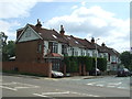


40 photos from this area
Area Information
Key information about the IG8 9QU including its size, population, and administrative classification.
- Area Type
- Postcode
- Area Size
- 1.2 hectares
- Population
- 1796
- Population Density
- 3535 people/km²
House Prices in IG8 9QU
19
Properties
£527,137
Average Sold Price
£164,000
Lowest Price
£920,000
Highest Price
Showing 19 properties
| Address | Type | Beds | Baths | Last Sale Price | Last Sale Date | |
|---|---|---|---|---|---|---|
| 36 The Charter Road, Woodford Green, IG8 9QU | Semi-detached | 6 | 2 | £877,500 | Feb 2024 | |
| 22 The Charter Road, Woodford Green, IG8 9QU | Semi-detached | 4 | 1 | £820,000 | Aug 2023 | |
| 4 The Charter Road, Woodford Green, IG8 9QU | Semi-detached | 4 | 2 | £830,000 | Feb 2021 | |
| 20 The Charter Road, Woodford Green, IG8 9QU | house | - | - | £805,000 | Feb 2021 | |
| 10 The Charter Road, Woodford Green, IG8 9QU | house | - | - | £920,000 | Feb 2021 | |
| 24 The Charter Road, Woodford Green, IG8 9QU | house | - | - | £720,000 | Nov 2015 | |
| 18 The Charter Road, Woodford Green, IG8 9QU | house | 5 | - | £548,332 | Jan 2012 | |
| 38 The Charter Road, Woodford Green, IG8 9QU | Terraced | - | - | £562,500 | Dec 2011 | |
| 8 The Charter Road, Woodford Green, IG8 9QU | Semi-detached | - | - | £540,000 | Oct 2006 | |
| 16 The Charter Road, Woodford Green, IG8 9QU | Semi-detached | - | - | £469,000 | Sep 2006 |
Page 1 of 2
Energy Efficiency in IG8 9QU
Amenities
Schools
| Rank | School | Type | Entry gender | Ages |
|---|
Explore more schools in this area
Go to Schools tabDemographics
Household Size
Family (3-5 people)
most common
Accommodation Type
Houses
most common
Tenure
60
majority
Ethnic Group
White
most common
Religion
N/A
most common
Household Composition
N/A
most common
Age
47
median
Adults (30-64 years)
most common
Household Deprivation
N/A
with no deprivation
NS-SEC
36
in Lower managerial occupations
Explore more demographic insights in this area
Go to Demographics tabPlanning
Planning Constraints
- Flood RiskPremium
- Ramsar Wetland SitesPremium
- Area of Outstanding Natural BeautyPremium
- Protected Nature ReservePremium
- Protected WoodlandPremium