Area Overview for IG8 9JP
Photos of IG8 9JP
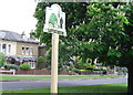
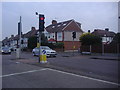
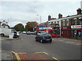
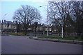
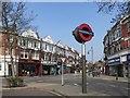

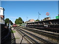
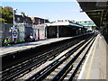
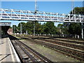
49 photos from this area
Area Information
Key information about the IG8 9JP including its size, population, and administrative classification.
- Area Type
- Postcode
- Area Size
- 5580 m²
- Population
- 1913
- Population Density
- 5127 people/km²
House Prices in IG8 9JP
18
Properties
£658,182
Average Sold Price
£445,000
Lowest Price
£990,000
Highest Price
Showing 18 properties
| Address | Type | Beds | Baths | Last Sale Price | Last Sale Date | |
|---|---|---|---|---|---|---|
| 8 Fairlight Avenue, Woodford Green, IG8 9JP | Semi-detached | 4 | 2 | £990,000 | Jul 2025 | |
| 9 Fairlight Avenue, Woodford Green, IG8 9JP | house | - | - | £720,000 | Oct 2023 | |
| 4 Fairlight Avenue, Woodford Green, IG8 9JP | house | - | - | £800,000 | Aug 2020 | |
| 15 Fairlight Avenue, Woodford Green, IG8 9JP | Semi-detached | 4 | - | £795,000 | Feb 2017 | |
| 1 Fairlight Avenue, Woodford Green, IG8 9JP | house | - | - | £615,000 | Dec 2013 | |
| 12 Fairlight Avenue, Woodford Green, IG8 9JP | house | 4 | - | £675,000 | Dec 2013 | |
| 10 Fairlight Avenue, Woodford Green, IG8 9JP | house | 4 | - | £675,000 | Dec 2013 | |
| 7 Fairlight Avenue, Woodford Green, IG8 9JP | Semi-detached | 4 | - | £445,000 | Jun 2012 | |
| 13 Fairlight Avenue, Woodford Green, IG8 9JP | house | - | - | £530,000 | Sep 2007 | |
| 3 Fairlight Avenue, Woodford Green, IG8 9JP | Semi-detached | - | - | £495,000 | Jul 2006 |
Page 1 of 2
Energy Efficiency in IG8 9JP
Amenities
Schools
| Rank | School | Type | Entry gender | Ages |
|---|
Explore more schools in this area
Go to Schools tabDemographics
Household Size
One person
most common
Accommodation Type
Flats
most common
Tenure
52
majority
Ethnic Group
White
most common
Religion
N/A
most common
Household Composition
N/A
most common
Age
47
median
Adults (30-64 years)
most common
Household Deprivation
N/A
with no deprivation
NS-SEC
43
in Lower managerial occupations
Explore more demographic insights in this area
Go to Demographics tabPlanning
Planning Constraints
- Flood RiskPremium
- Ramsar Wetland SitesPremium
- Area of Outstanding Natural BeautyPremium
- Protected Nature ReservePremium
- Protected WoodlandPremium