Area Overview for IG8 9BQ
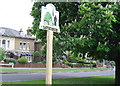
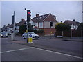
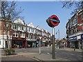
Photos of IG8 9BQ


Area Information
Living in IG8 9BQ offers a quiet, residential experience within a small cluster of homes. With a population of 1,532, this area is compact yet well-connected, balancing local convenience with proximity to broader networks. The community is predominantly composed of adults aged 30–64, suggesting a stable, middle-aged demographic. Home ownership is high at 68%, reflecting a settled population. The area’s safety is a key feature, with a crime risk score of 84, indicating below-average crime rates. Digital connectivity is strong, with broadband rated excellent (91) and mobile coverage good (85), supporting both daily use and remote work. Nearby amenities include multiple retail outlets, rail, and metro stations, ensuring practical access to shopping, transport, and services. While the area lacks natural beauty designations, its low flood risk and absence of environmental constraints make it a straightforward place to live. Families may appreciate the presence of St Aubyn’s School, an independent institution, though the broader educational landscape remains unexplored in the data. Overall, IG8 9BQ is a no-nonsense, functional community ideal for those prioritising safety, connectivity, and simplicity.
- Area Type
- Postcode
- Area Size
- Not available
- Population
- 1532
- Population Density
- 6286 people/km²
The property market in IG8 9BQ is characterised by a high rate of home ownership (68%) and a focus on houses rather than flats or apartments. This suggests a community where long-term residency is the norm, with limited turnover of rental properties. The predominance of houses may indicate a preference for spacious, family-friendly living, though the exact size or condition of these properties is not specified. As a small area, the housing stock is likely limited, meaning buyers should consider the broader surrounding region for more options. The high home ownership rate also implies that the area may not be a hotspot for investors or renters, making it a niche market for those seeking stability. For buyers, the lack of flats or newer developments could mean fewer choices, but the existing houses may offer value in a low-risk, low-maintenance environment.
House Prices in IG8 9BQ
No properties found in this postcode.
Energy Efficiency in IG8 9BQ
Residents of IG8 9BQ have access to a range of amenities that support daily life. Retail options include major chains like Tesco Woodford, Waitrose South, and the Chelmsford Star Co-operative Society, offering a mix of grocery and general shopping. Public transport is extensive, with metro, rail, and bus services connecting to key destinations. While the data does not mention parks or leisure facilities, the presence of multiple stations suggests proximity to recreational areas or town centres. The area’s small size means amenities are concentrated, reducing the need for long commutes. The convenience of nearby shops, combined with reliable transport links, creates a self-sufficient environment. However, the lack of specific details on dining or cultural venues means the full lifestyle offering remains partially unexplored.
Amenities
Schools
The nearest school to IG8 9BQ is St Aubyn’s School, an independent institution. While no Ofsted rating is provided, the presence of an independent school suggests a focus on private education, which may appeal to families seeking specific curricula or facilities. However, the data does not include information on state schools or their performance, so the full range of educational options in the area remains unclear. For parents prioritising independent schooling, St Aubyn’s offers a dedicated option, but those requiring state-funded education may need to look further afield. The absence of additional schools in the data means the area’s educational landscape is not fully represented, though the existing school provides a clear starting point for families.
| Rank | School | Type | Entry gender | Ages |
|---|
Explore more schools in this area
Go to Schools tabDemographics
The demographic profile of IG8 9BQ is defined by a median age of 47, with the majority of residents falling within the 30–64 age range. This suggests a population largely in their prime working and family-raising years. Home ownership is robust at 68%, indicating a stable, long-term resident base. The accommodation type is predominantly houses, which aligns with the area’s small, residential character. The predominant ethnic group is White, though no specific diversity metrics are provided. The absence of data on deprivation or other socioeconomic factors means the quality of life cannot be fully contextualised, but the high home ownership and low crime risk imply a relatively secure environment. The age distribution suggests a community with established careers and family structures, potentially offering a mature, low-entropy lifestyle. With no mention of rental properties or transient populations, the area appears to cater to those seeking permanence over flexibility.
Household Size
Accommodation Type
Tenure
Ethnic Group
Religion
Household Composition
Age
Household Deprivation
NS-SEC
Explore more demographic insights in this area
Go to Demographics tabPlanning
Planning Constraints
- Flood RiskPremium
- Ramsar Wetland SitesPremium
- Area of Outstanding Natural BeautyPremium
- Protected Nature ReservePremium
- Protected WoodlandPremium